
Tag: Georgian
-
How close did Ino get? Japan’s first measured map against a modern one
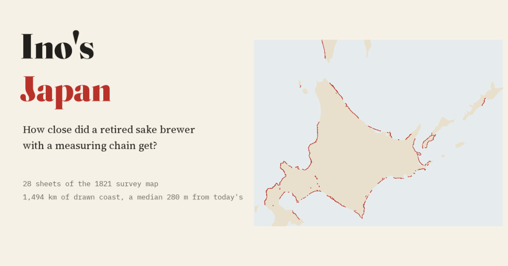
A retired sake brewer measured Japan on foot. I laid 28 sheets of his 1821 map on today’s coast: a typical sheet’s coast sits a median 280 m from the modern line.
-
Transported: every convict ship to Australia, mapped
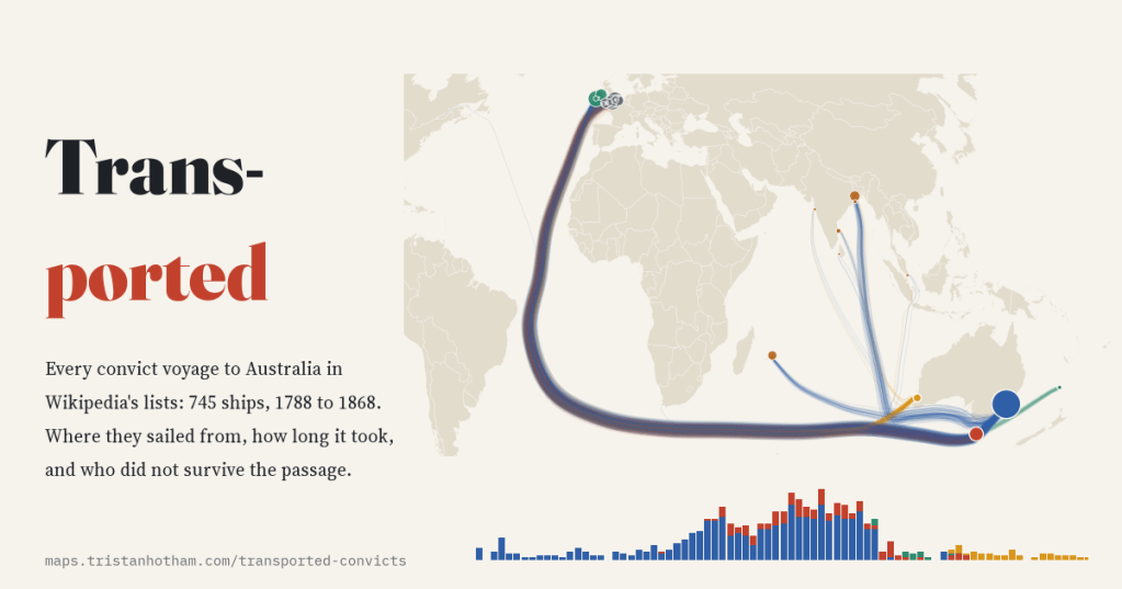
Britain shipped about 162,000 convicts to Australia. I mapped all 745 voyages in Wikipedia’s ship lists: the busiest port was Cork, the busiest year 1833, and the Second Fleet lost a quarter of its convicts at sea.
-
Fencing the commons: every enclosure Act in England and Wales, mapped
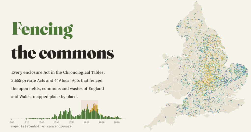
I mapped every enclosure Act in Parliament’s chronological tables, 4,104 of them, place by place. They came in two waves, and 48% were passed in the years of war with France, when wheat was dear.
-
Ships before steam: the trade-wind highways of the age of sail, drawn from real logbooks
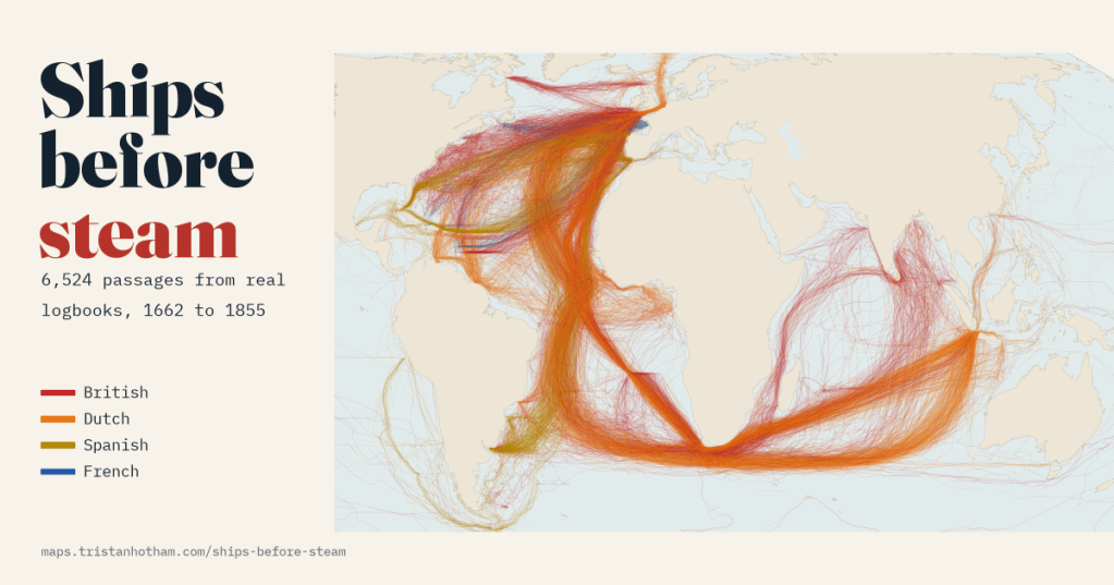
6,524 passages from British, Dutch, Spanish and French ships’ logbooks, 1750 to 1850. Drawn as lines, they show ships running out with the trade winds, looping home past the Azores and racing east through the roaring forties to Java.
-
Shipwrecks of the world, and how many over time
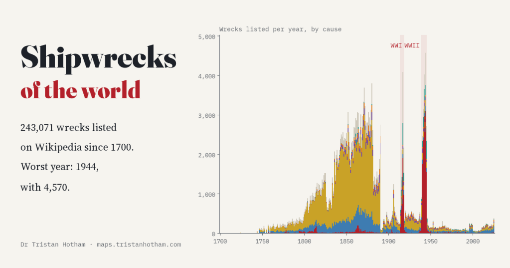
Wikipedia lists 243,071 shipwrecks since 1700. I counted them year by year: three of the five worst years are war years, with 1944 the worst. The huge 1800s plateau owes a lot to British newspapers.

