
Tag: industry
-
What’s left of the workhouse? Buildings, street names and famine graves across Britain and Ireland
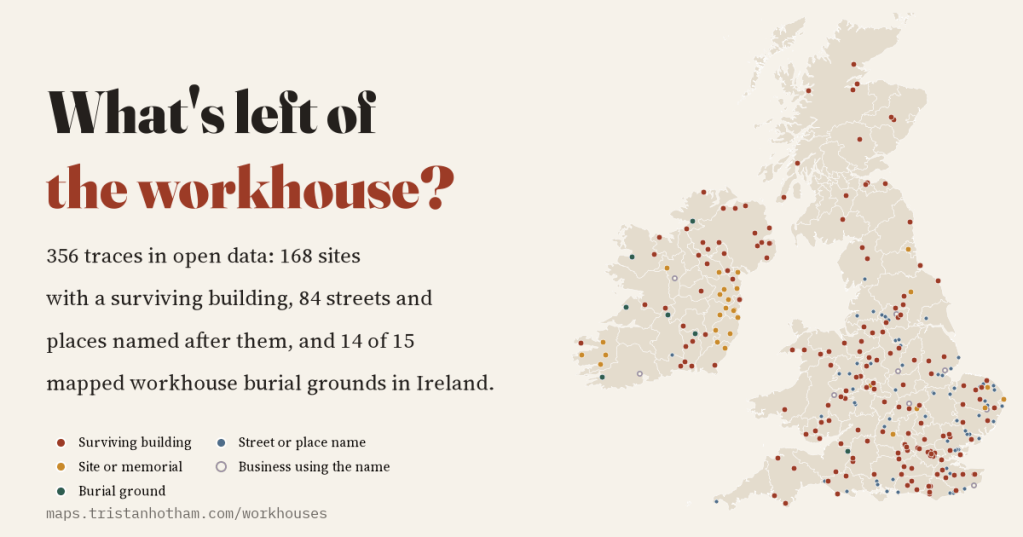
There is no open list of Britain and Ireland’s workhouses, so I mapped what they left behind in open data: 356 traces, from hospitals and flats to Workhouse Lanes, and 14 of 15 mapped workhouse burial grounds in Ireland.
-
Ships before steam: the trade-wind highways of the age of sail, drawn from real logbooks
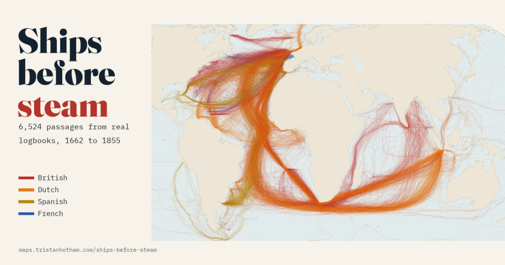
6,524 passages from British, Dutch, Spanish and French ships’ logbooks, 1750 to 1850. Drawn as lines, they show ships running out with the trade winds, looping home past the Azores and racing east through the roaring forties to Java.
-
Fencing the commons: every enclosure Act in England and Wales, mapped
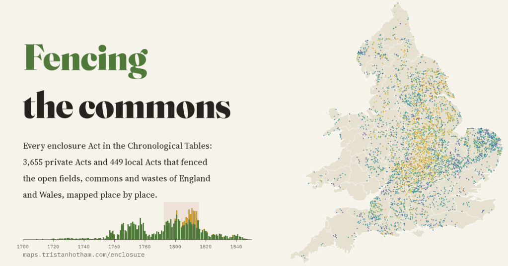
I mapped every enclosure Act in Parliament’s chronological tables, 4,104 of them, place by place. They came in two waves, and 48% were passed in the years of war with France, when wheat was dear.
-
Booth’s poverty map today
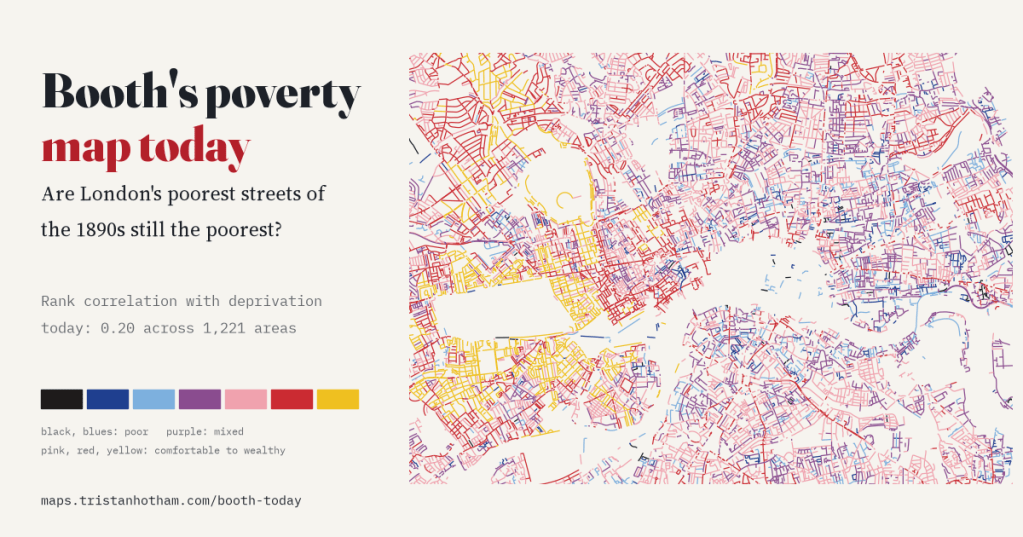
I read Charles Booth’s 1898 to 1899 poverty colours along every street of today’s inner London and set them against deprivation in 2025. The poorer streets of the 1890s are still slightly more deprived (rank correlation 0.20), and only very locally: slide the old map 1 km and most of the link goes.
-
Who owns your street?
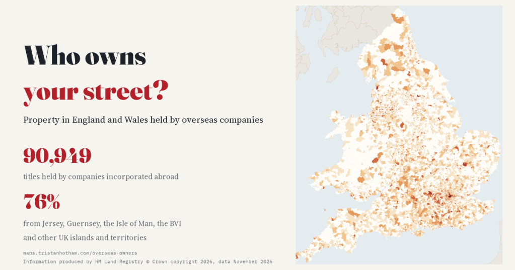
90,949 property titles in England and Wales are held by companies incorporated abroad. I mapped them for every small area: 76% are held from Jersey, Guernsey, the Isle of Man, the BVI and the UK’s other islands and territories.

