
Tag: weather and climate
-
Ships before steam: the trade-wind highways of the age of sail, drawn from real logbooks
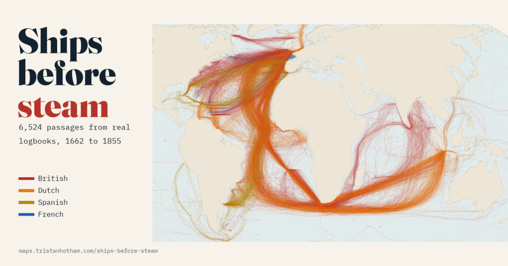
6,524 passages from British, Dutch, Spanish and French ships’ logbooks, 1750 to 1850. Drawn as lines, they show ships running out with the trade winds, looping home past the Azores and racing east through the roaring forties to Java.
-
Every storm since 1851: where hurricanes form, where they hit, and are they getting stronger?
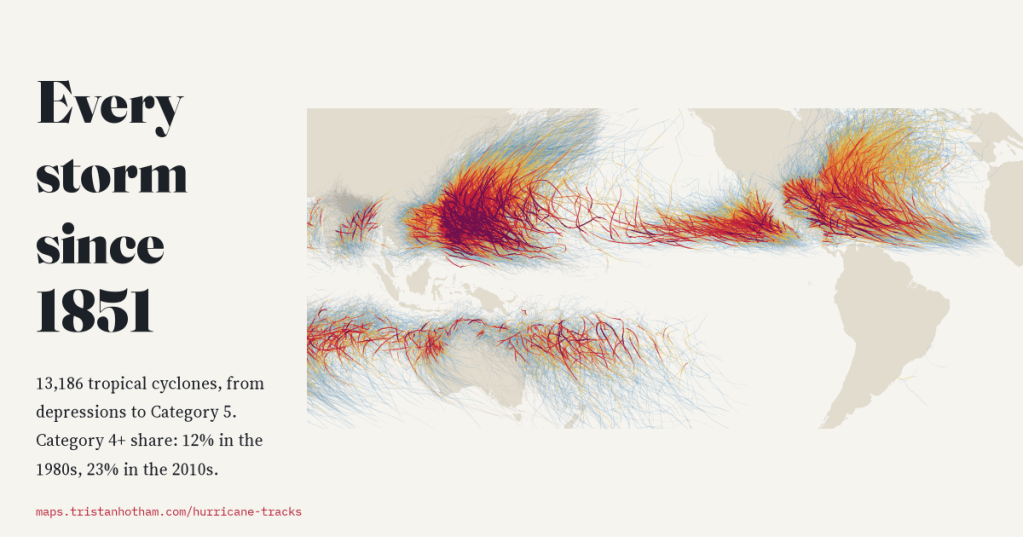
I mapped all 13,186 tropical cyclones in NOAA’s global archive, from depressions to Category 5 typhoons. The number of storms has not changed since 1980, but more of them reach Category 4 or 5 and they peak further from the equator. Before satellites, the record misses too many storms to say much more.
-
Drowned valleys: the villages flooded for reservoirs in the age of big dams
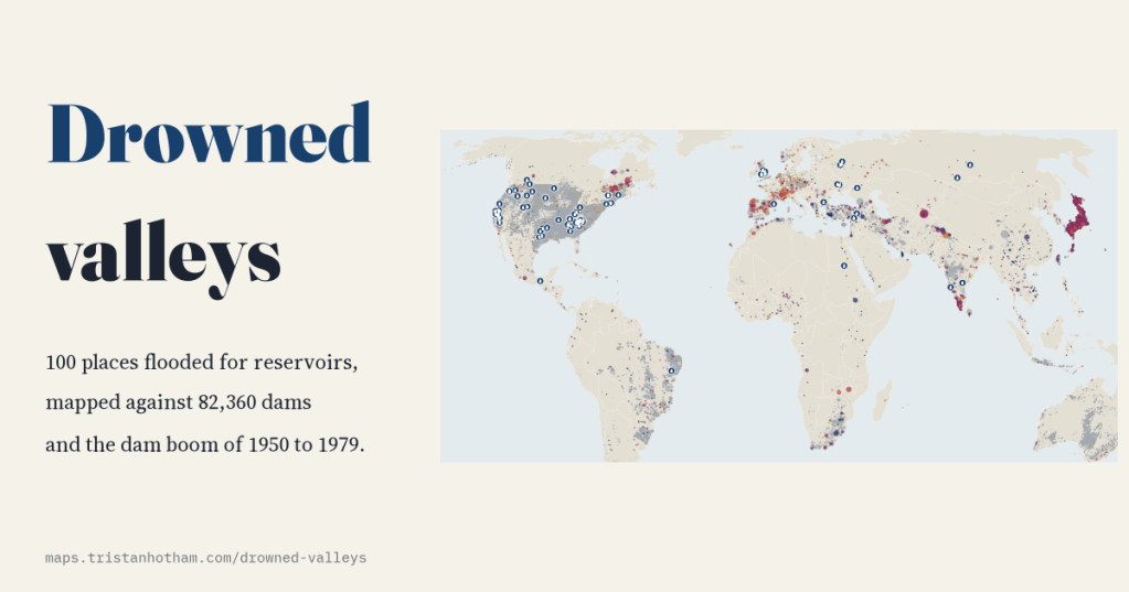
From Capel Celyn to Mologa and the Lost Villages of the St Lawrence, I mapped the 100 places Wikipedia records as flooded by reservoirs. Most went under between 1930 and 1979, just as the world’s dam building peaked.
-
Where the wind blows: the world’s winds, and are wind farms in the windy places?
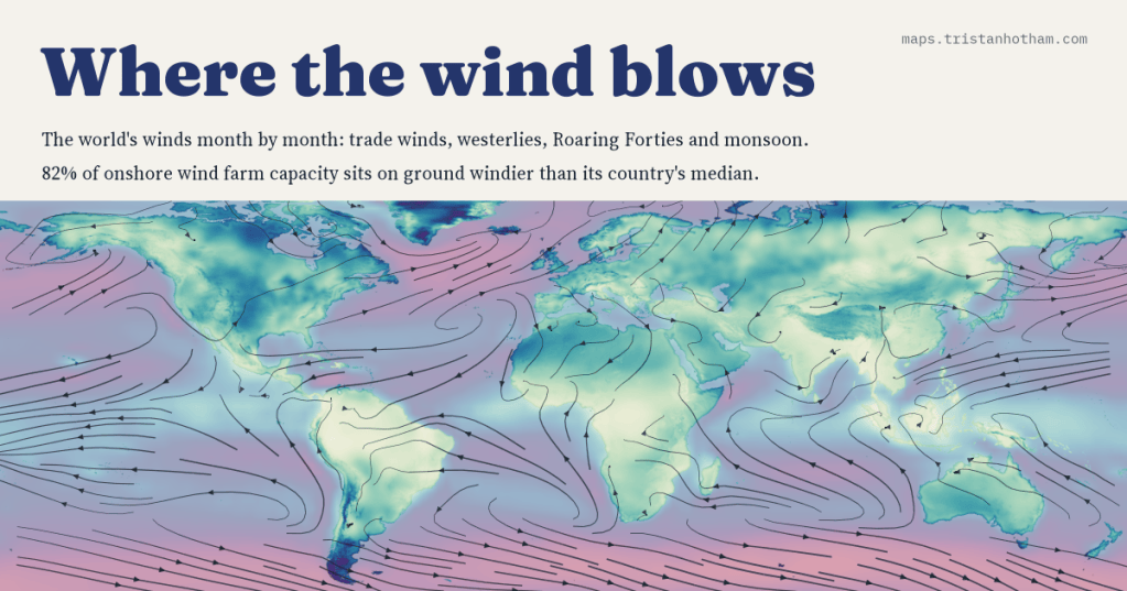
I mapped the world’s winds month by month, from the trade winds to the Roaring Forties and the monsoon, and set 5,344 wind farms against the wind at their sites. 82% of onshore capacity stands on ground windier than its country’s median.
-
When the ice came south: the ice ages mapped, and what lies under them today
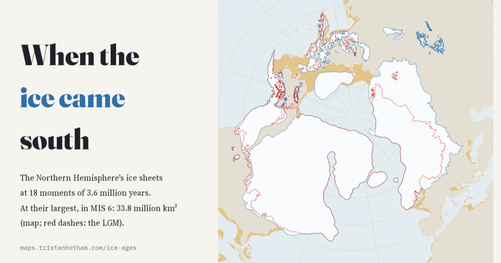
I mapped the Northern Hemisphere’s ice sheets at 18 moments of the last 3.6 million years. The last ice age was only the 4th largest; 709 of today’s cities and towns, New York among them, stand on ground its ice covered.

