
Category: Data stories
-
What the world calls each other
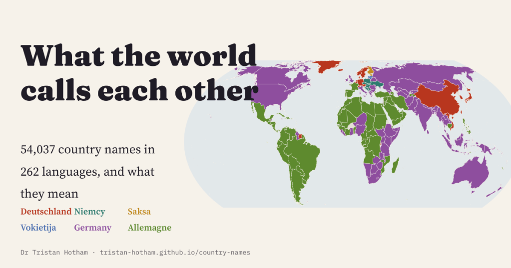
I mapped 54,037 country names in 262 languages. Most countries are called something like their own name almost everywhere, but Germany has six families of names, and Chinese ‘virtue country’ and ‘beautiful country’ are mostly sound.
-
Hard water: the world’s water hardness and the rocks behind it
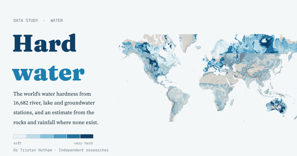
A world map of water hardness from 16,682 river, lake and groundwater stations, and a simple model that guesses it from the rocks: Scandinavia’s median is 14 mg/l, the Yucatán’s 514.
-
Britain in AD 500: what the ground tells us
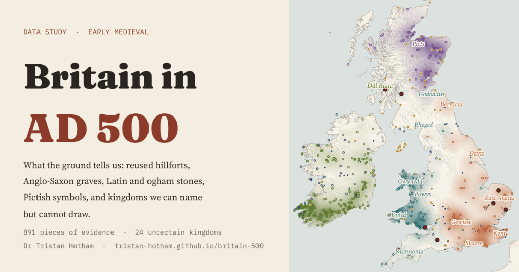
Maps of Britain in AD 500 show neat kingdoms. I mapped what the ground can place instead: 891 pieces of evidence, a sharp east of graves and west of stones, and 24 kingdoms we can name but not draw.
-
The footpath capital of Britain
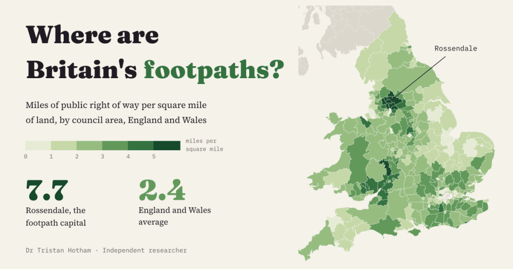
Which part of Britain has the most public footpaths per square mile? From the councils’ own data: Rossendale, with 7.7 miles of right of way per square mile, and the South Pennine mill towns fill the top ten. Powys has the most per person; Harrow the fewest of anywhere with a definitive map.
-
The rocks beneath: a geological map in the colours of 1969
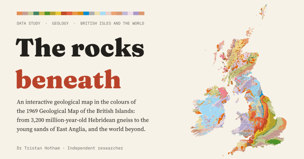
An interactive geological map of the British Isles and the world, coloured with the palette of the 1969 Geological Map of the British Islands. Carboniferous rocks cover 17.5% of Great Britain, and England’s layers get younger all the way to London.

