
Tag: world maps
-
Where the world’s islands are
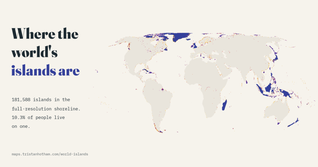
I counted every island in a detailed open map of the world’s shorelines: 181,588 of them, 23,150 over a square kilometre. Canada has the most, and 10.3% of the world’s people live on one.
-
A lidar map of the world: the ground beneath the trees
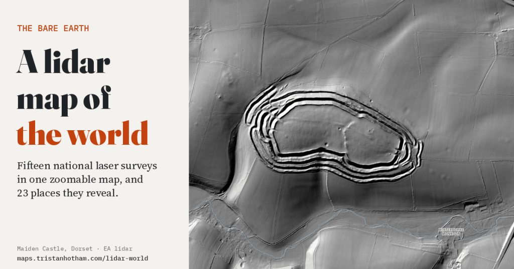
Fifteen national laser surveys in one zoomable map. Hillforts hidden in forests, the craters of Verdun, the mine craters of Messines, Roman gold mines and the biggest burial mound in Japan: what the land looks like with every tree and building taken away.
-
The Peutinger Table: a Roman road map that squashed the world
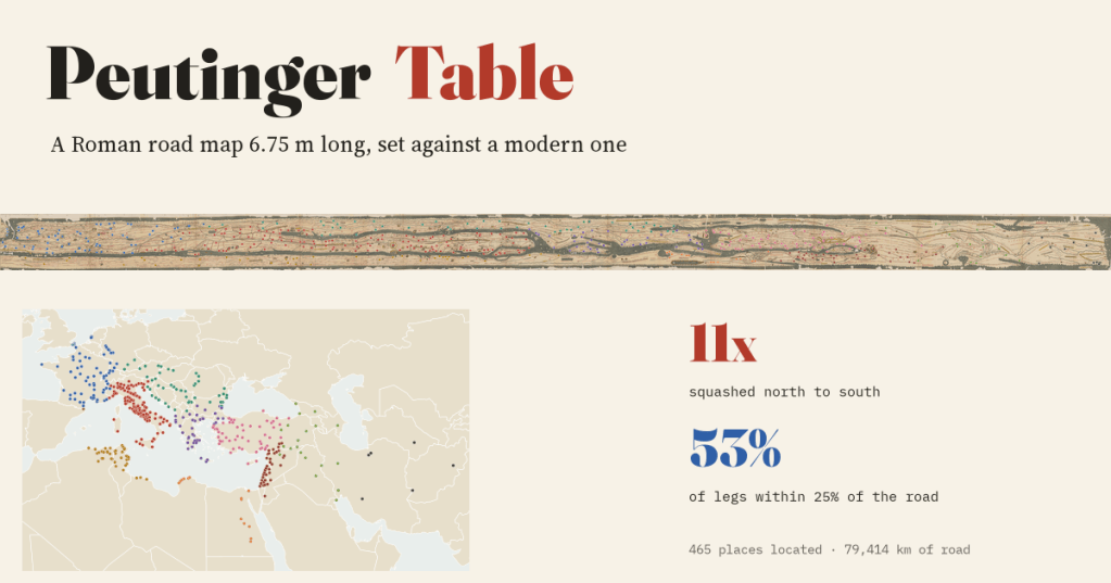
I set a Roman road map 6.75 m long beside a modern one. It squashes the world 11 times north to south, yet 53% of its road distances are within 25% of the real road, and it switches to Gallic leagues exactly where it says it does.
-
Every storm since 1851: where hurricanes form, where they hit, and are they getting stronger?
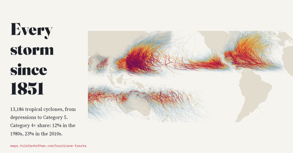
I mapped all 13,186 tropical cyclones in NOAA’s global archive, from depressions to Category 5 typhoons. The number of storms has not changed since 1980, but more of them reach Category 4 or 5 and they peak further from the equator. Before satellites, the record misses too many storms to say much more.
-
Where the borders are straight: who drew the world’s ruler lines, and is Africa really the straightest?
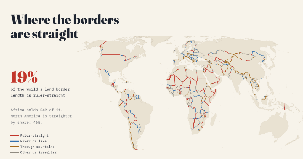
I measured every land border on Earth. 19% is ruler-straight, and Africa holds 54% of it, but North America is straighter by share. Plus the treaties behind the 40 longest straight lines.

