
Tag: world maps
-
Ghost towns of the world: where places were abandoned, and why
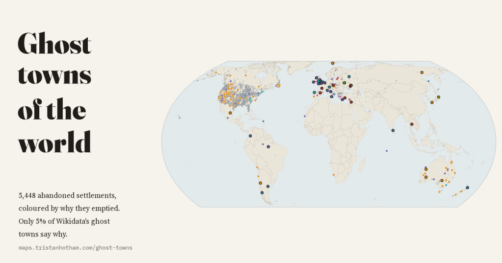
I mapped 5,448 abandoned settlements in open data and coloured each by why it emptied: mining, war, disaster, reservoirs, Chernobyl and medieval decline. 80% of Wikidata’s ghost towns are American, and only 5% say why.
-
Where every film was shot: film cities, foreign productions and James Bond on one map
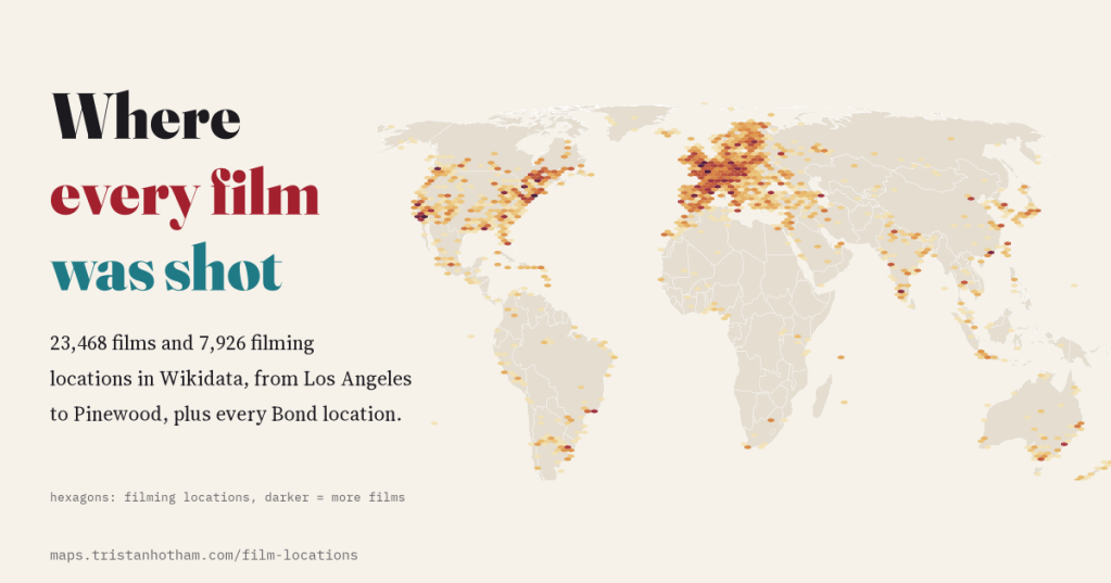
I mapped the filming locations of 23,468 films in Wikidata: Los Angeles, New York, London and Paris lead, Canada hosts the most foreign productions, and the 25 Eon Bond films visited 36 countries and territories.
-
A Tolkien-style map of the whole world, drawn from real data
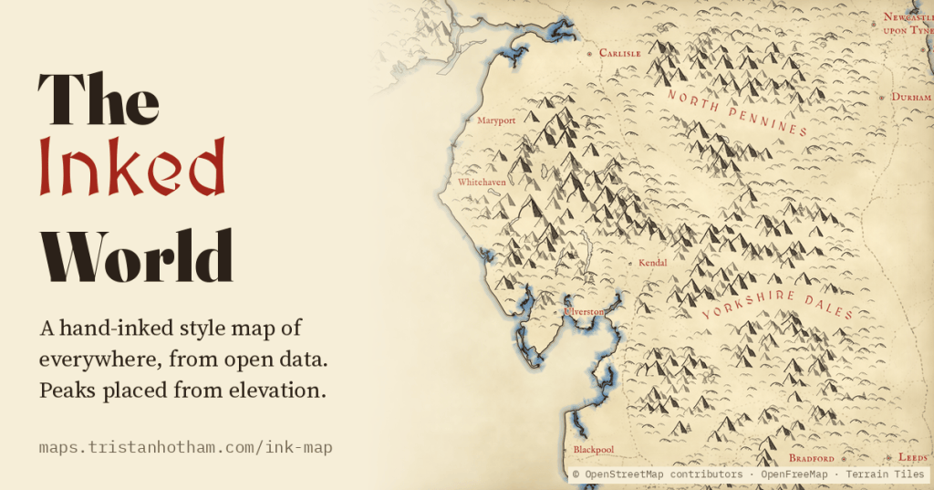
A Tolkien-style map of the whole world, zoomable from continents to single hills: little ink peaks on the real high ground, forests of tiny trees, rippled coasts, red lettering and towns drawn as tiny houses, all generated from open data.
-
The first websites: how the web spread around the world
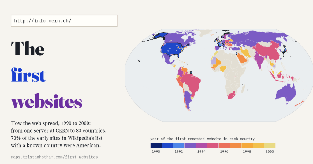
From one server at CERN in December 1990 to 83 countries with a recorded website by 2000. I coded Wikipedia’s list of 119 websites founded before 1995 and added 2,208 more from Wikidata: the web began with physicists and was soon overwhelmingly American, at least in the English-language memory of it.
-
Where space rocks land, and why the meteorite record is so lumpy
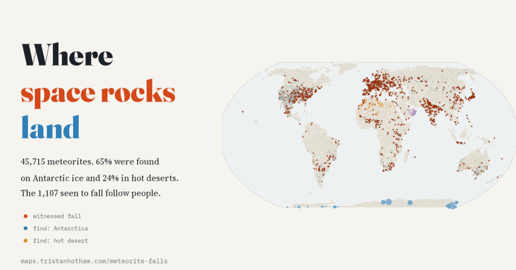
I mapped 45,715 meteorites from the Meteoritical Society’s catalogue. 65% were found on Antarctic ice and 24% in hot deserts, while the 1,107 seen to fall follow people, not the sky.

