
Tag: world maps
-
The Peutinger Table: a Roman road map that squashed the world
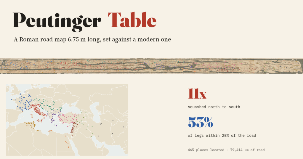
I set a Roman road map 6.75 m long beside a modern one. It squashes the world 11 times north to south, yet 53% of its road distances are within 25% of the real road, and it switches to Gallic leagues exactly where it says it does.
-
Every storm since 1851: where hurricanes form, where they hit, and are they getting stronger?
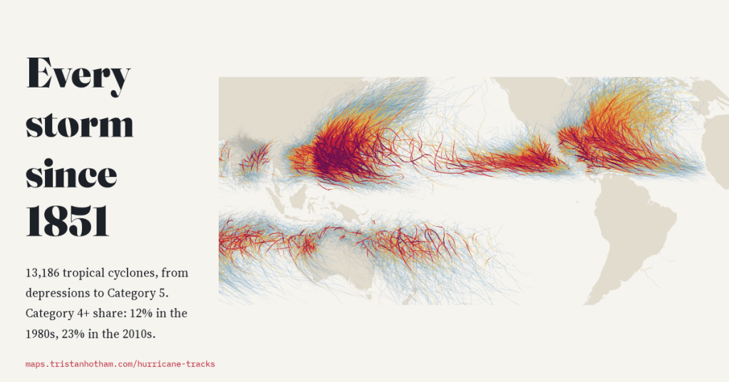
I mapped all 13,186 tropical cyclones in NOAA’s global archive, from depressions to Category 5 typhoons. The number of storms has not changed since 1980, but more of them reach Category 4 or 5 and they peak further from the equator. Before satellites, the record misses too many storms to say much more.
-
Where the borders are straight: who drew the world’s ruler lines, and is Africa really the straightest?
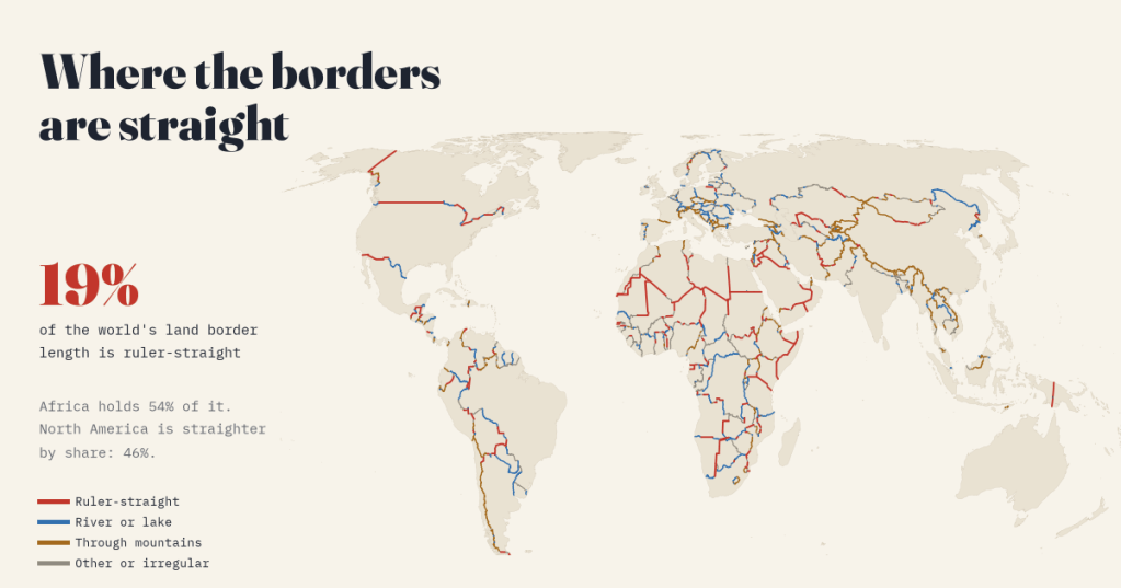
I measured every land border on Earth. 19% is ruler-straight, and Africa holds 54% of it, but North America is straighter by share. Plus the treaties behind the 40 longest straight lines.
-
Junk on the Moon and Mars: every human-made object on two worlds, mapped
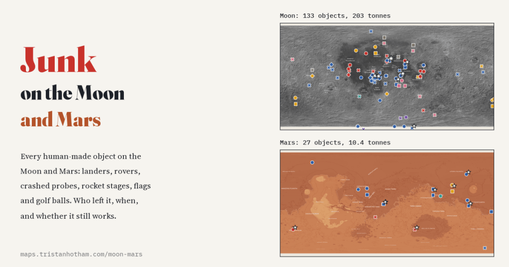
I mapped every human-made object on the Moon and Mars from Wikipedia’s lists: 133 on the Moon and 27 on Mars, 203 tonnes and 10.4 tonnes. A third of the Moon’s junk is five Saturn V rocket stages, and almost all of it is dead.
-
Al-Idrisi’s world: the map made for Roger II of Sicily, set against a modern one
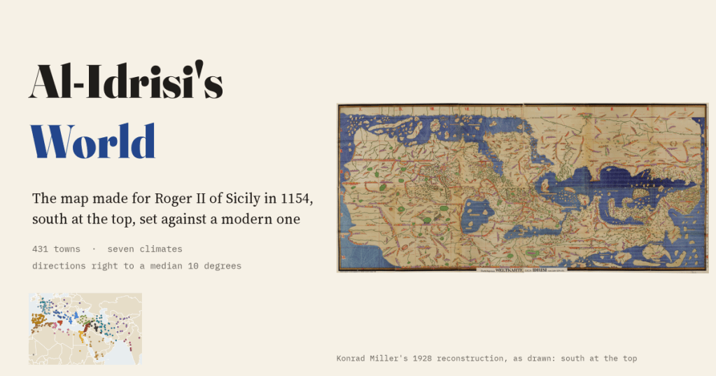
In 1154 a Muslim geographer in Palermo drew the known world for the Norman king of Sicily, south at the top. I read 431 of its towns and measured it: directions right to a median 10 degrees, and Sicily drawn best and biggest of all.

