
Tag: Poverty and wealth
-
What’s left of the workhouse? Buildings, street names and famine graves across Britain and Ireland
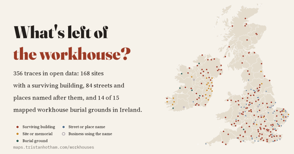
There is no open list of Britain and Ireland’s workhouses, so I mapped what they left behind in open data: 356 traces, from hospitals and flats to Workhouse Lanes, and 14 of 15 mapped workhouse burial grounds in Ireland.
-
The Wealth of Nations, Mapped
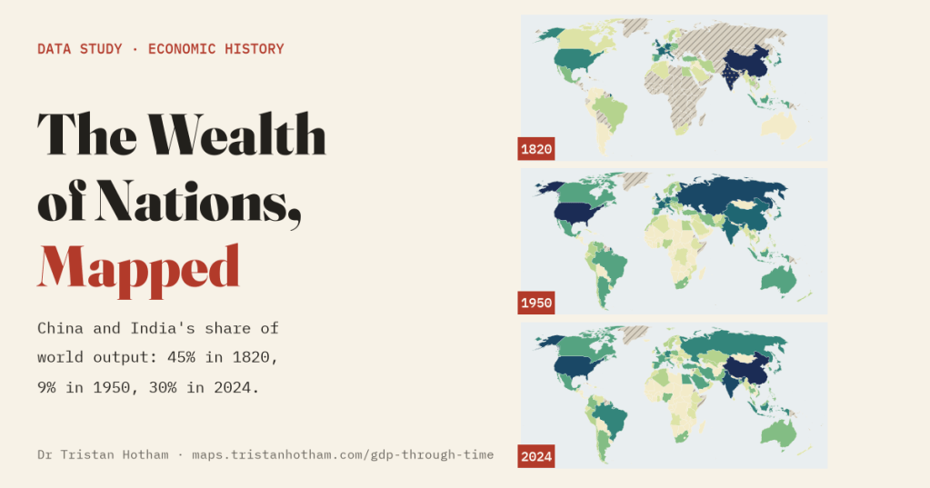
The world economy on one map you can play, from 10,000 BC to 2024. China and India made 45% of the world’s output in 1820, 9% in 1950 and 30% in 2024, and the further back you go the more of the map is guesswork.
-
Bus deserts: the villages with no bus and the last bus home
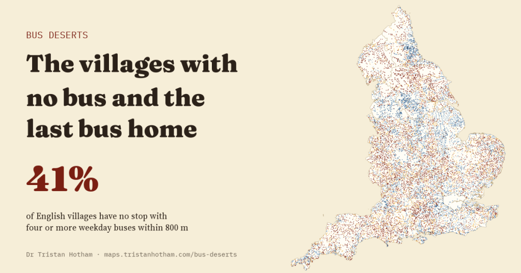
I counted every timetabled bus in England on a Tuesday, Saturday and Sunday and checked every village. 41% have no stop with four or more weekday buses within 800 metres, 62% have no bus after seven in the evening and 68% have none on Sunday.
-
Booth’s poverty map today
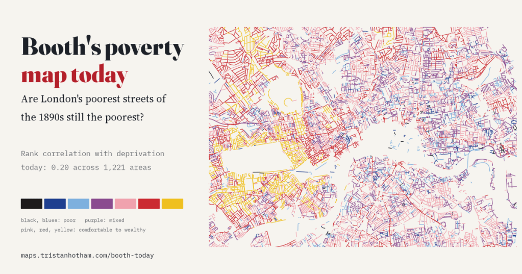
I read Charles Booth’s 1898 to 1899 poverty colours along every street of today’s inner London and set them against deprivation in 2025. The poorer streets of the 1890s are still slightly more deprived (rank correlation 0.20), and only very locally: slide the old map 1 km and most of the link goes.
-
Who owns your street?
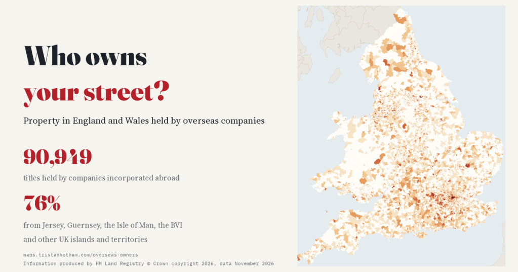
90,949 property titles in England and Wales are held by companies incorporated abroad. I mapped them for every small area: 76% are held from Jersey, Guernsey, the Isle of Man, the BVI and the UK’s other islands and territories.

