
Tag: Persistence test
-
Booth’s poverty map today
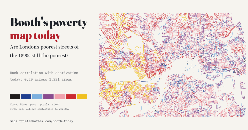
I read Charles Booth’s 1898 to 1899 poverty colours along every street of today’s inner London and set them against deprivation in 2025. The poorer streets of the 1890s are still slightly more deprived (rank correlation 0.20), and only very locally: slide the old map 1 km and most of the link goes.
-
Does the 1974 border still show?
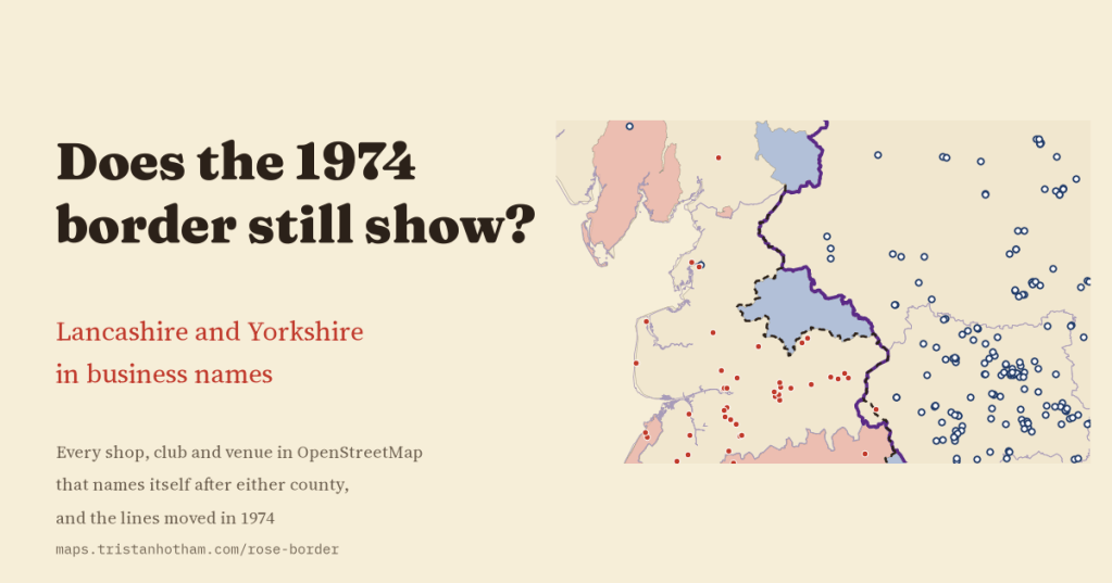
I mapped every business in OpenStreetMap named after Lancashire or Yorkshire. My planned main test, in the places that left Yorkshire, could not be answered. But the old border is sharp where it did not move, and the Lancashire name thins in Greater Manchester and Merseyside.
-
Roundhead or Cavalier, Leave or Remain?
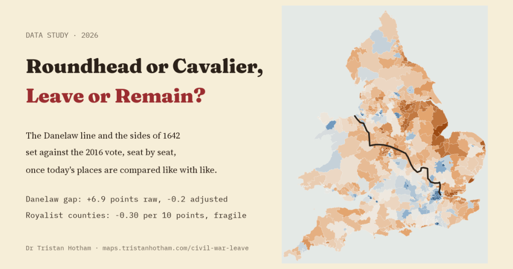
Seats on the Danelaw side of Alfred and Guthrum’s line voted Leave by 6.9 points more. Compared like with like, the gap is -0.2. Counties whose members sided with the King: a small, fragile link the other way.
-
Lost kingdoms on the high street
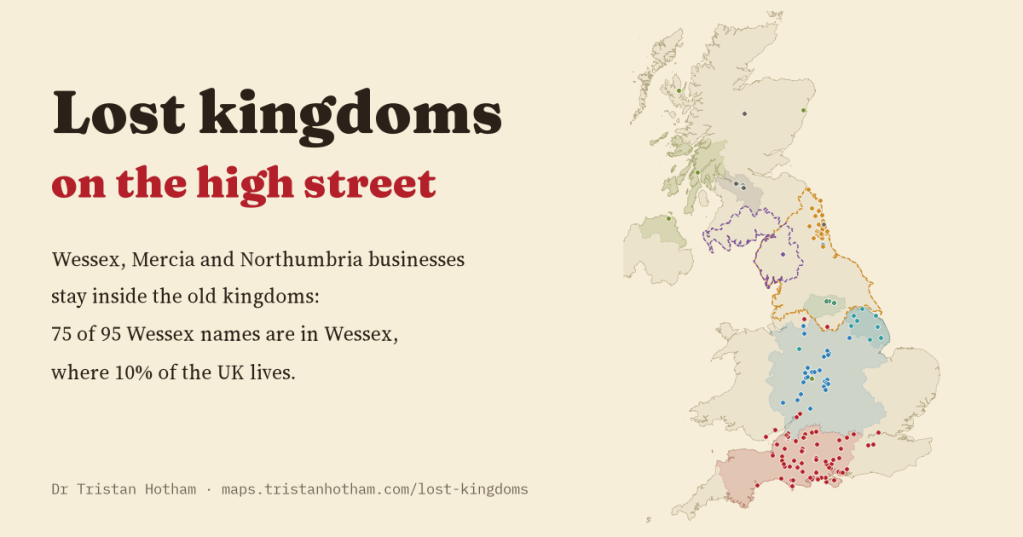
Wessex, Mercia and Northumbria vanished more than a thousand years ago, but their names are still on shop signs. 75 of 95 Wessex businesses are in Wessex, and all 33 Northumbria businesses are in Northumbria.
-
Did the Pits Closing Still Show?
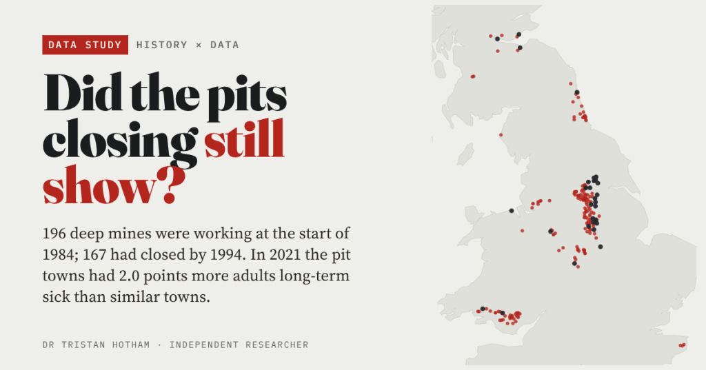
196 deep mines were working in Britain at the start of 1984, and 167 had closed by 1994. Forty years on, the pit towns of England and Wales have 2.0 points more adults long-term sick than similar towns, whenever their pit closed.

