
Tag: world maps
-
The middle of nowhere: the places on Earth farthest from any town
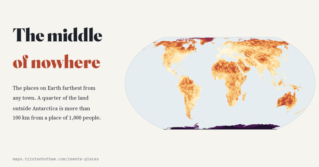
I measured how far every point on land is from the nearest town of 1,000 people. A quarter of the land outside Antarctica is more than 100 km from one; the most landlocked place on Earth is just 65 km from one; and Britain’s middle of nowhere is near Cape Wrath.
-
Lighthouses of the world: every light on one glowing map
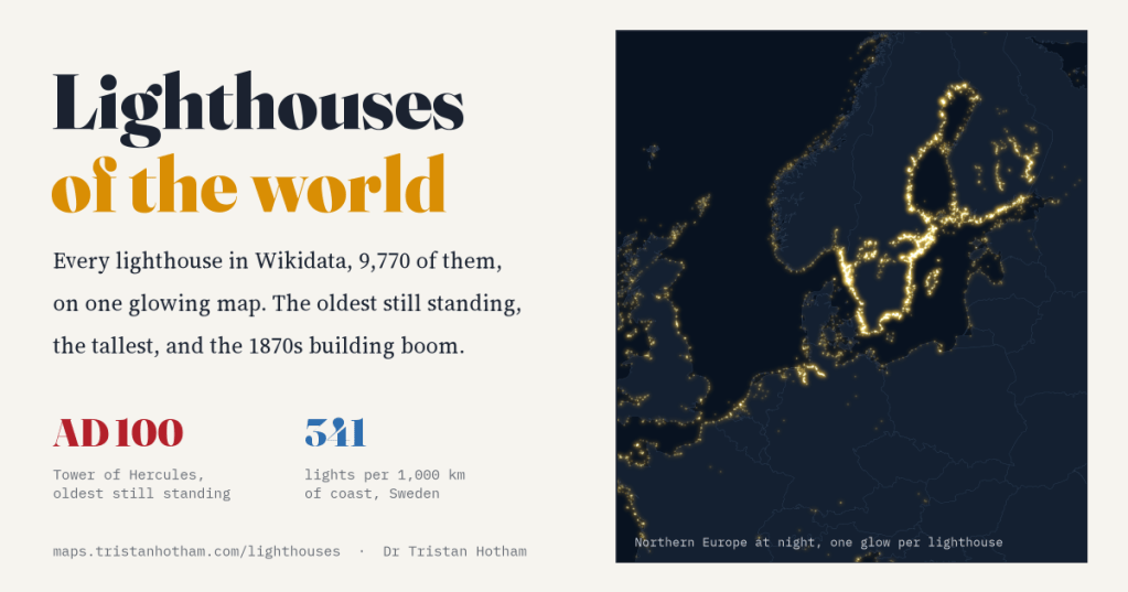
Wikidata knows of 9,770 lighthouses. I mapped them all and switched them on. Most were built in the industrial century, the oldest still standing is Roman, and the brightest coast belongs to Sweden, partly because Sweden wrote its lights down.
-
Who held the map? Twelve centuries of the world in flags
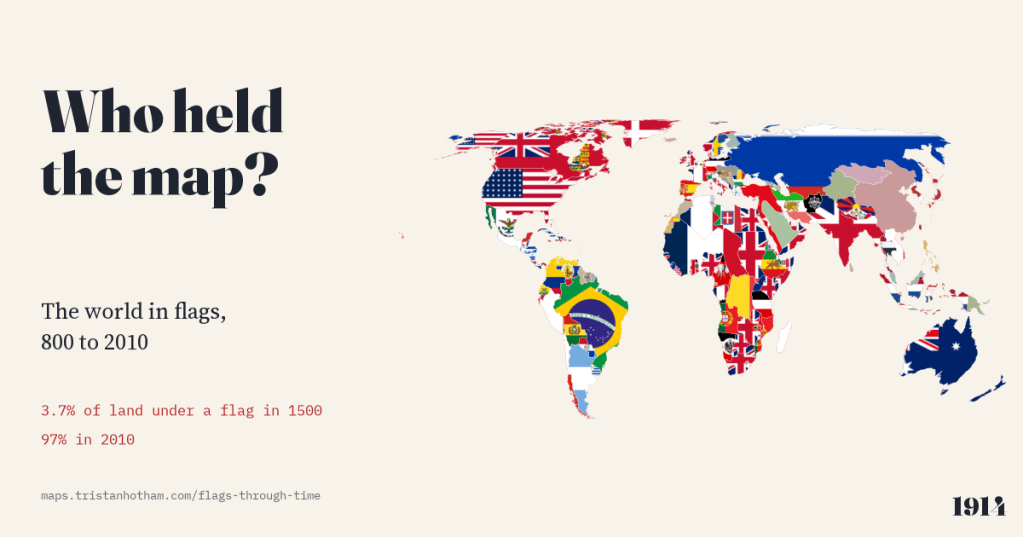
The world map from 800 to 2010, each piece of land filled with the flag of whoever held it. In 1000 no land can honestly be shown with a flag; in 1500, 3.7%; by 2010, 97%.
-
How deep is the sea? The ocean floor, its trenches and seamounts, on one map
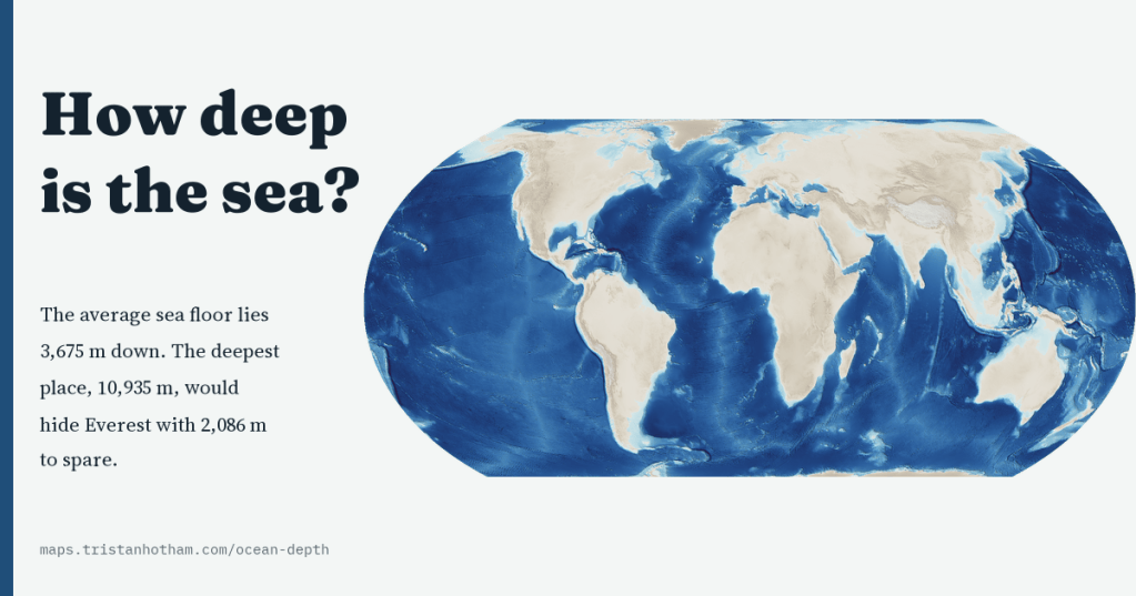
A map of the floor of the whole ocean, sharp from ocean basins to seamounts. The average sea floor lies 3,675 m down, 74% of it is abyssal, the Challenger Deep would hide Everest with 2,086 m to spare, and only 28.7% of the floor is mapped to modern standards.
-
Every tsunami on record: where they start, where the water went, and who died
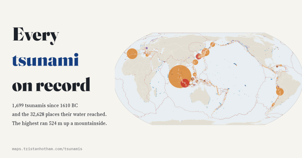
I mapped all 1,699 tsunamis in NOAA’s Global Historical Tsunami Database since 1610 BC and the places their water reached. 72% started with an earthquake, the highest ran 524 m up a mountainside, and 2004 alone accounts for 42% of recorded deaths.

