
Tag: world maps
-
Where games are set, and where they are made
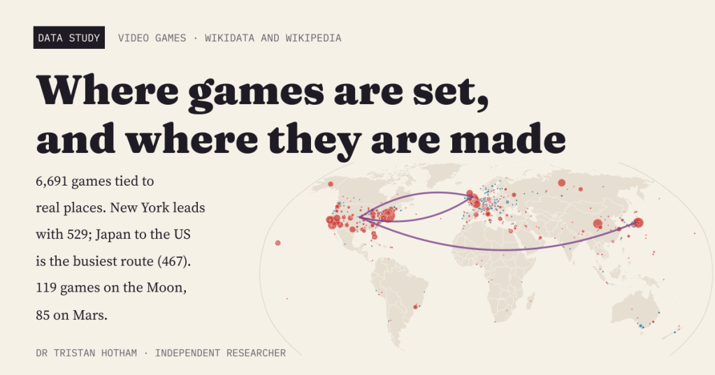
A world map of 6,691 video games tied to real places: where each is set and where its studio is based. New York leads, Japan to the United States is the busiest route, and the Moon beats Mars.
-
What grows where: the trees of Britain and the world
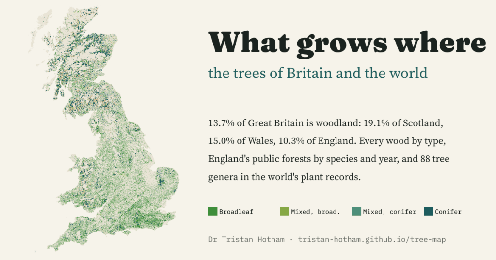
An explorable map of every wood in Great Britain by type, England’s public forests by species and planting year, and 88 tree genera in the world’s plant records. Woodland covers 13.7% of Great Britain: 19.1% of Scotland but 10.3% of England.
-
What the world calls each other
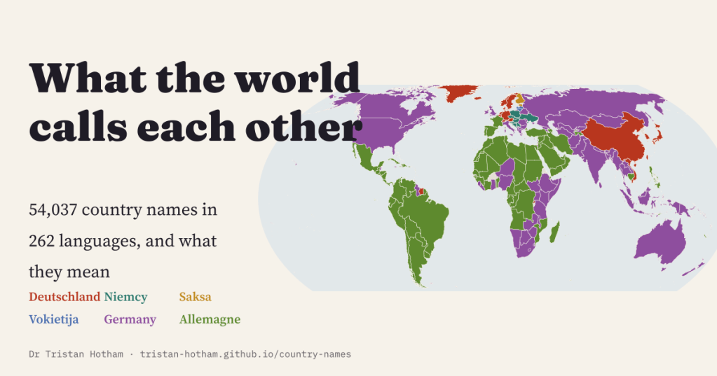
I mapped 54,037 country names in 262 languages. Most countries are called something like their own name almost everywhere, but Germany has six families of names, and Chinese ‘virtue country’ and ‘beautiful country’ are mostly sound.
-
Hard water: the world’s water hardness and the rocks behind it
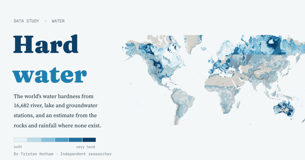
A world map of water hardness from 16,682 river, lake and groundwater stations, and a simple model that guesses it from the rocks: Scandinavia’s median is 14 mg/l, the Yucatán’s 514.
-
Drowned and rising: Britain and the world at every sea level
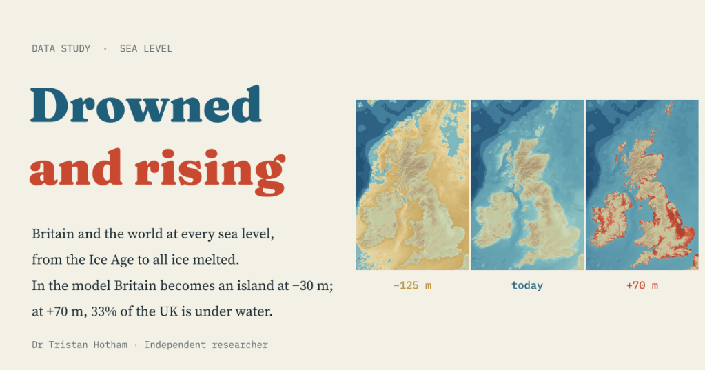
A bathtub model of every sea level from the Ice Age to an ice-free world. In the model Britain becomes an island at −30 m; at +70 m, 33% of the UK is under water.

