
Tag: world maps
-
What does the world eat? National dishes, breakfasts and regional food on one map
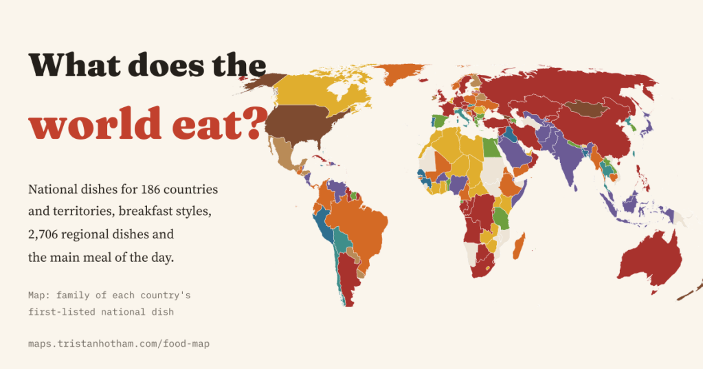
National dishes for 186 countries and territories, breakfast styles for 73, and 2,706 regional dishes from fabada in Asturias to takoyaki in Osaka, mapped from Wikipedia and Wikidata. And why there is no lunch map.
-
Darkest skies: where you can still see the Milky Way
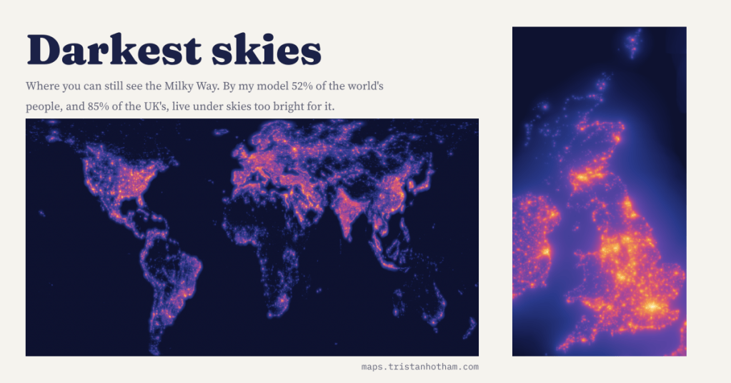
I modelled the glow of the world’s lights from satellite images and checked it against 6,653 sky meter readings. By my count 52% of people, and 85% in the UK, cannot see the Milky Way from home.
-
How wrong is your clock?
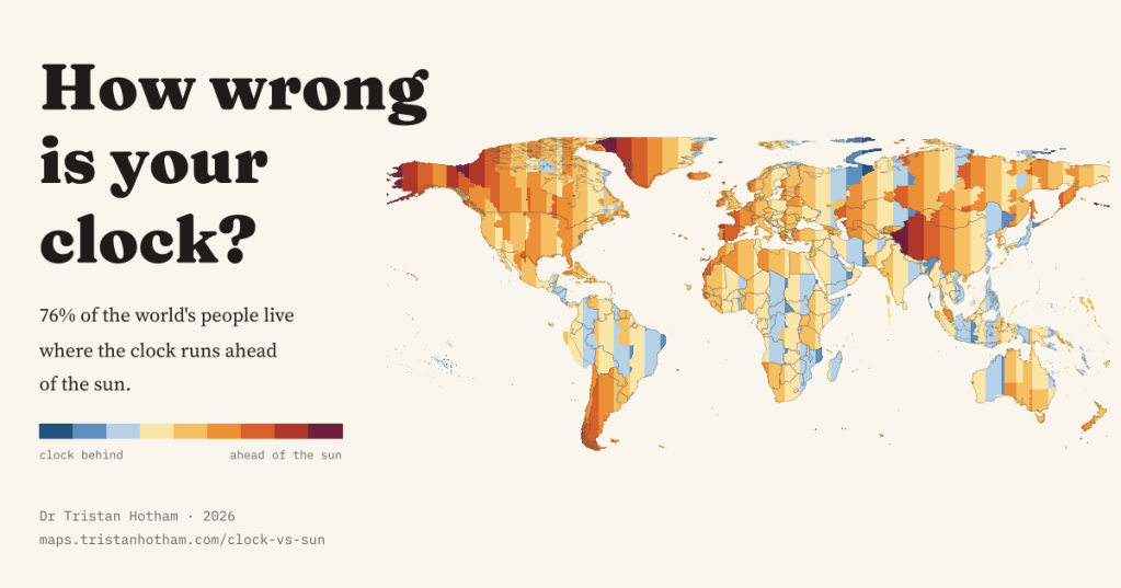
For 76% of the world’s people the clock runs ahead of the sun. I measured the gap everywhere, and found out why winter mornings in Galicia stay dark until after nine.
-
Signature sports: where the world’s niche games are unusually popular
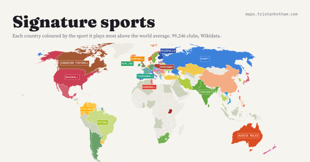
Every country plays football, but which sport does each country play far more than the world? From 99,246 clubs: pesäpallo in Finland (70x the world average), tchoukball in Switzerland, hurling in Ireland, speedway in Poland.
-
Born here, loved there: where dog breeds come from, and where they are loved
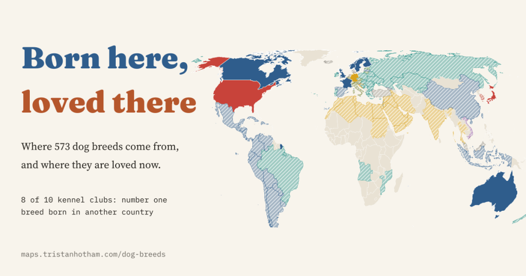
I mapped 573 dog breeds to their countries of origin and set them against kennel club registrations. In 8 of 10 countries the favourite dog was born somewhere else.

