
Tag: food and drink
-
What the world grows: farmland and crops on one map
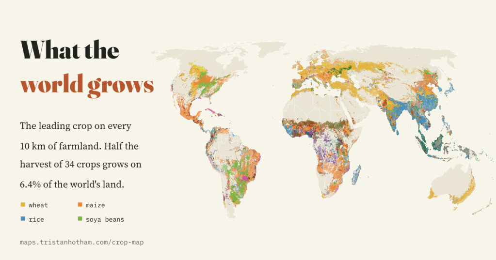
The leading crop on every 10 km square of the world’s farmland, and sixty years of change in how much land we farm. Wheat, maize, rice and soya beans cover 50% of the harvest, and half of it grows on 6.4% of the world’s land.
-
Where the animals are: the world’s cattle, sheep, goats, pigs and chickens on one map
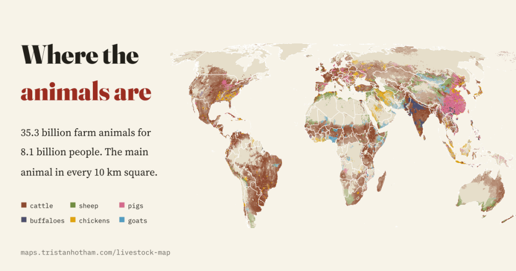
35.3 billion farm animals for 8.1 billion people, mapped every 10 km. Chickens have multiplied 7.1 times since 1961, farm mammals outnumber people in 40 countries, and New Zealand has lost two thirds of its sheep.
-
Dinner, tea or supper? What Britain calls its evening meal
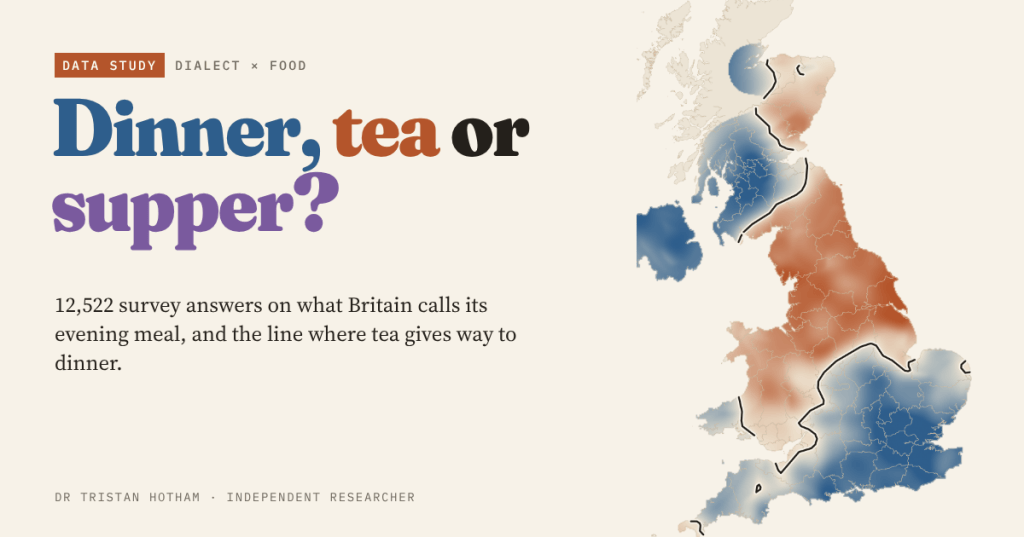
12,522 answers from the Our Dialects survey, mapped: tea in the north, dinner in the south, a tea line across the Midlands, and no sign of dinner moving north.
-
Did enclosure cause the Swing riots? A test on every parish
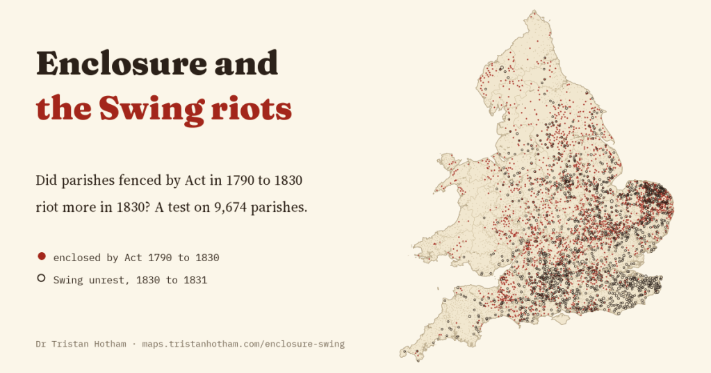
Historians have long blamed enclosure for the Swing riots of 1830. I linked every enclosure Act to 9,674 parishes and wrote the test down first: enclosed parishes rioted a little more, but the gap looks like parish size, not grievance.
-
What does the world drink? Wine, beer, spirits, sake and national drinks on one map
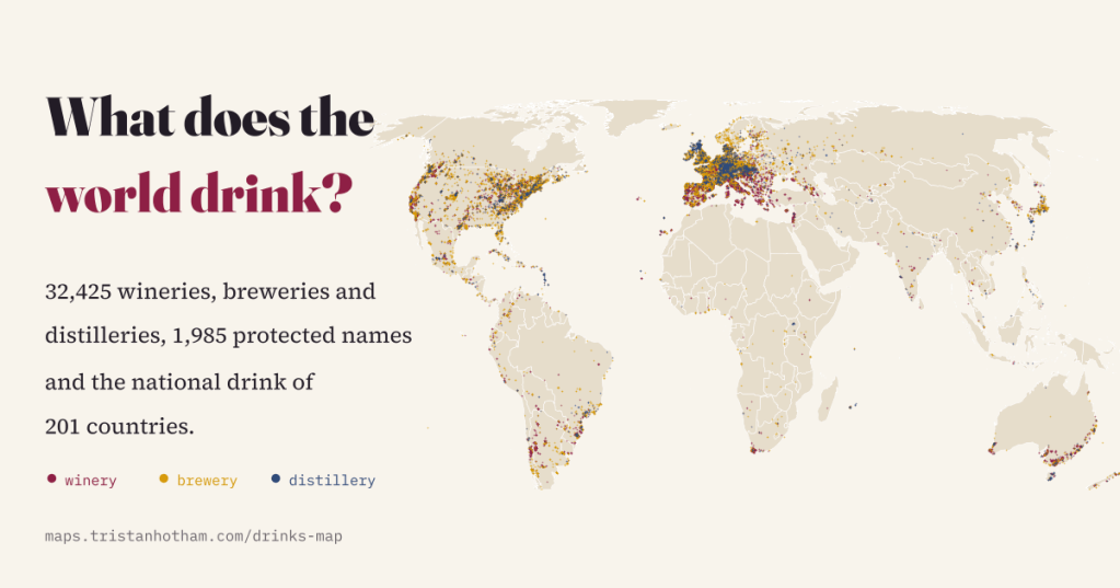
1,985 protected drink names, 32,425 wineries, breweries and distilleries and the national drink of 201 countries, mapped from open data. The national drink is often tea, and the map says as much about who keeps the records as about who drinks.

