
Tag: coast and sea
-
Pirate hotspots, then and now
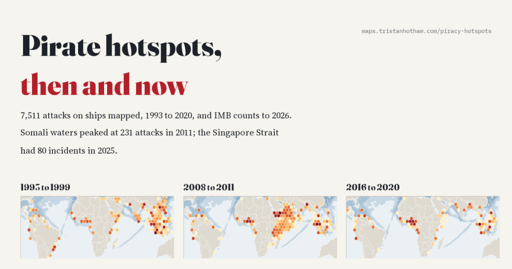
I mapped 7,511 pirate attacks from 1993 to 2020 and followed the hotspots as they moved, from the Strait of Malacca to Somalia and the Gulf of Guinea. In 2025 the busiest pirate waters were the Singapore Strait, and in 2026 Somali hijackers are back.
-
Transported: every convict ship to Australia, mapped
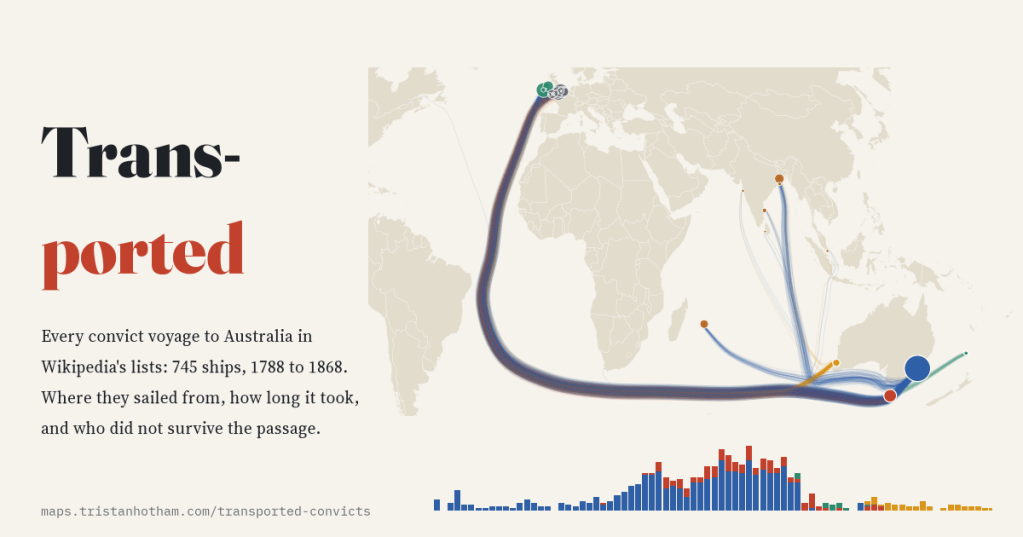
Britain shipped about 162,000 convicts to Australia. I mapped all 745 voyages in Wikipedia’s ship lists: the busiest port was Cork, the busiest year 1833, and the Second Fleet lost a quarter of its convicts at sea.
-
The internet’s seabed: every submarine cable, when it was laid, and the choke points
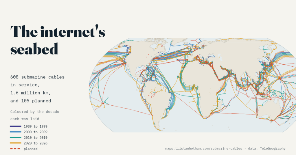
608 cables on the sea floor carry the internet between continents. I mapped when each was laid, how Google, Meta, Amazon and Microsoft came to part-own 55% of the planned length, and the straits and beaches where dozens squeeze through together.
-
How close did Ino get? Japan’s first measured map against a modern one
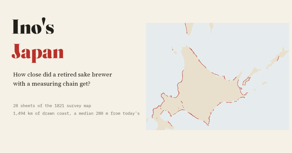
A retired sake brewer measured Japan on foot. I laid 28 sheets of his 1821 map on today’s coast: a typical sheet’s coast sits a median 280 m from the modern line.
-
Who named Antarctica? Twenty thousand place names, the nations that gave them and the people they honour
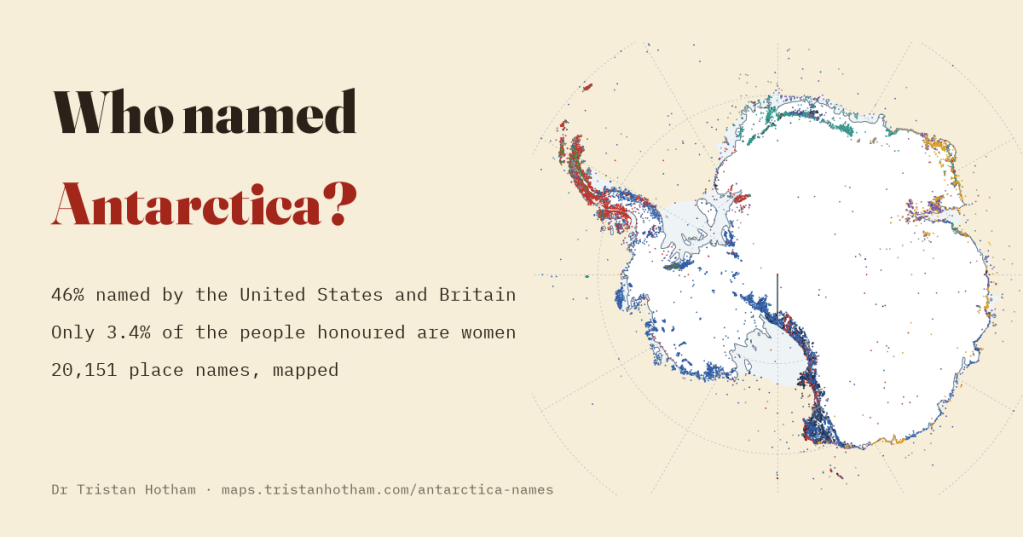
I mapped 20,151 Antarctic place names by who named them, when and after whom. America and Britain named 46% of the continent, and only 3.4% of the people honoured are women.

