
Tag: coast and sea
-
Who named Antarctica? Twenty thousand place names, the nations that gave them and the people they honour
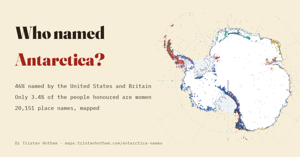
I mapped 20,151 Antarctic place names by who named them, when and after whom. America and Britain named 46% of the continent, and only 3.4% of the people honoured are women.
-
Can you see the sea?
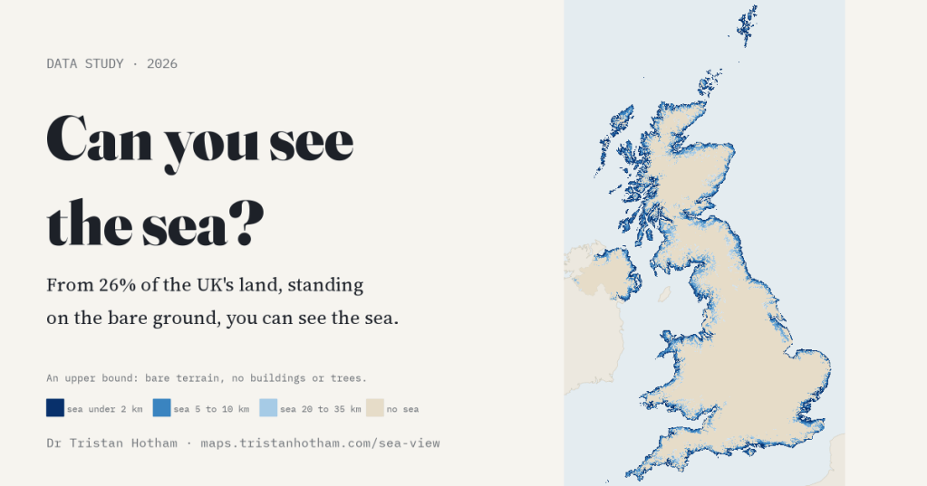
I traced 360 sight lines from every 1 km square of the UK. Standing on the bare ground, 26% of the land has the sea in view; from an upstairs window, 29%. The farthest square from any sea view is near Donington le Heath.
-
Where the lifeboats go: five years of RNLI launches mapped
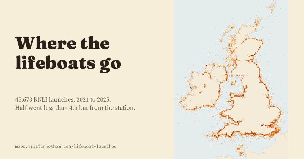
I looked at all 45,673 RNLI lifeboat launches from 2021 to 2025. Half went less than 4.5 km from the station, summer belongs to leisure boats, and the busiest station of all is on the Thames.
-
HMS Your Town: which British towns have had a warship named after them?
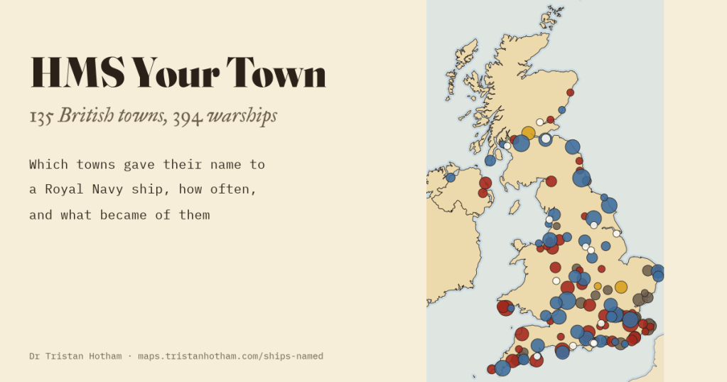
I matched every Royal Navy ship in Wikidata to the British towns they are named after: 394 ships for 135 towns. Gloucester and Newcastle have had nine each; Lancaster four; Barrow none.
-
How accurate were portolan charts?
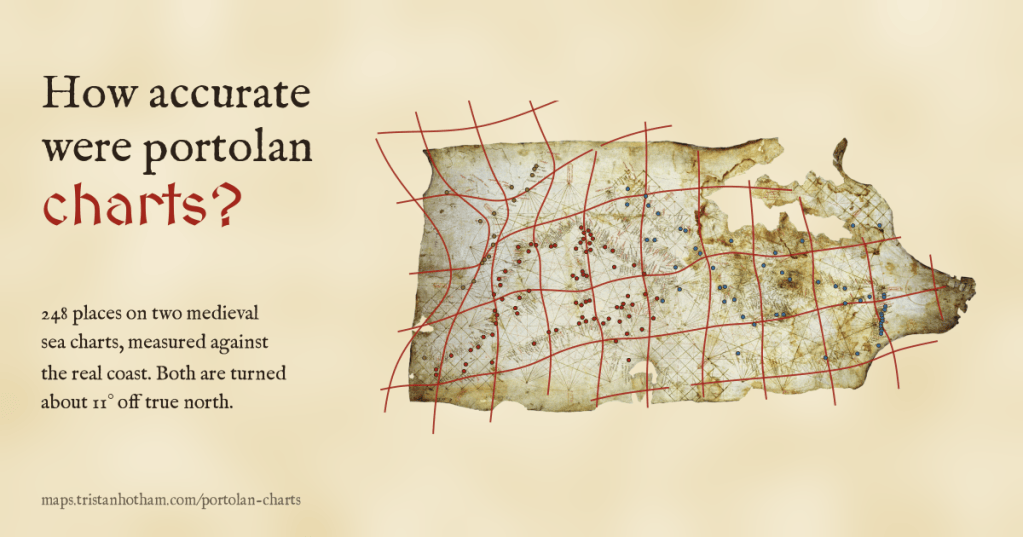
I read 349 places on the Carta Pisana and the Catalan Atlas and measured them against the real coast. Both charts are turned about 11 degrees off north, the Mediterranean is drawn to within a few dozen kilometres, and beyond Gibraltar they fall apart.

