
Tag: Pleiades
-
Ptolemy’s world, measured
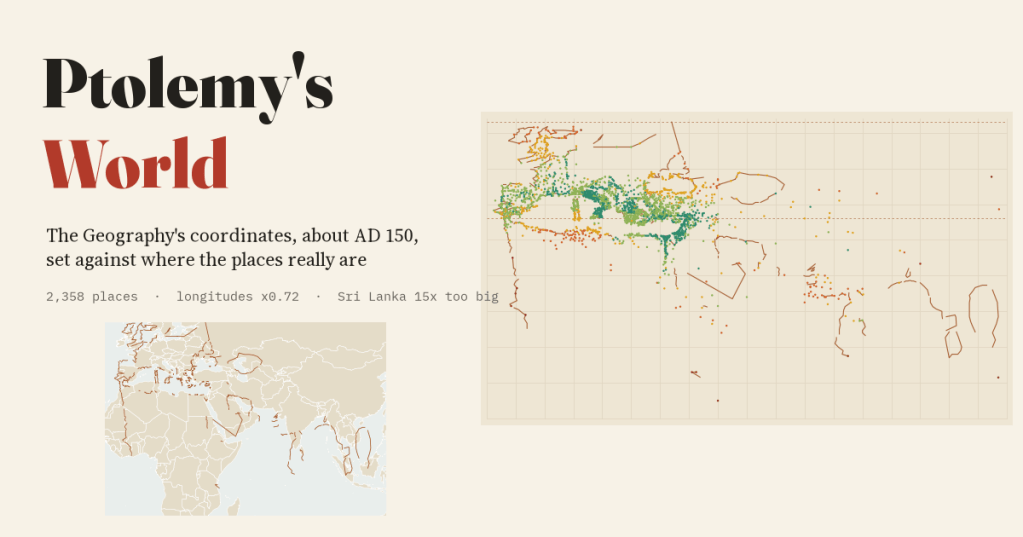
Ptolemy wrote the ancient world down as a table of coordinates. I matched 2,358 of his places to where they really are: shrink his longitudes by 0.72 and the map falls into place, but Scotland is still turned on its side and Sri Lanka is 15 times too big.
-
The world according to the Hereford Mappa Mundi
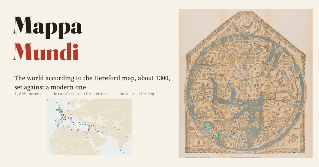
I set the largest surviving medieval map of the world beside a modern one. Its directions from Jerusalem are mostly right; its scale is not: the Holy Land is drawn 4.5 times too big, and Britain has 8% of its names.
-
By road and by sea: the fastest way from Rome to anywhere in the Roman Empire
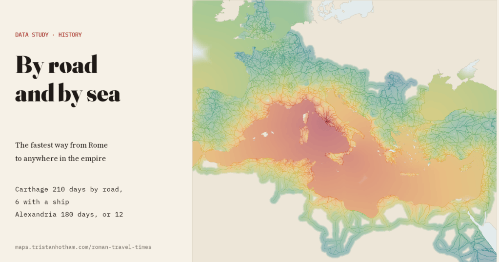
By road alone Carthage was 210 days’ walk from Rome. With a ship it was 6. I added the sea to my map of Roman roads, with sailing speeds from ancient voyages and the summer etesian winds.
-
The High Ones
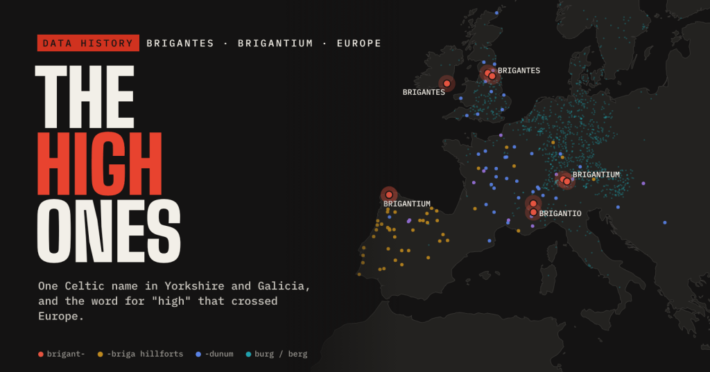
The Brigantes of northern England and the Brigantium of A Coruña share a name. A data history of the Celtic word for ‘high’, from -briga hillforts to burg, borough and Berg, and what it says about a Galicia–Yorkshire connection.

