
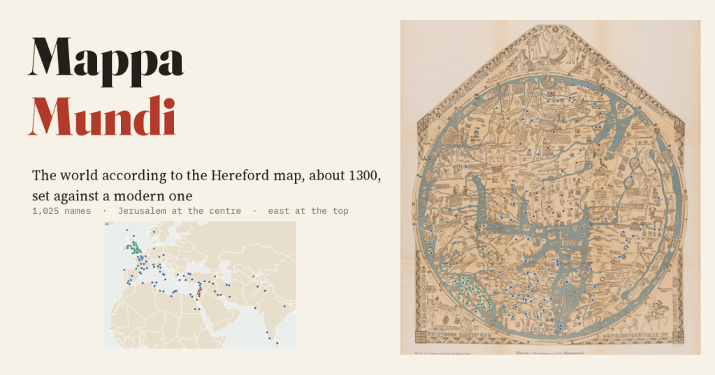
The Hereford Mappa Mundi, painted around 1300, is the largest medieval map of the world that survives. I took the 1,025 names that two Victorian clergymen indexed on it, matched them to real places, and set the map beside a modern one.
In Hereford Cathedral hangs a sheet of calfskin about 158 cm tall and 133 cm wide. It is a map of the whole world as an educated Englishman imagined it around 1300, and you could not travel by it. Jerusalem sits at the exact centre. East is at the top, where the Garden of Eden floats in a ring of fire. The Mediterranean runs up the middle like the stem of a T, splitting Europe on the left from Africa on the right. The far edge of the world is crowded with dog-headed men, one-footed Sciapods and people with their faces in their chests. And yet it is also full of real places: Paris, Rome, Babylon, Samarkand, and dozens of English cathedral towns.
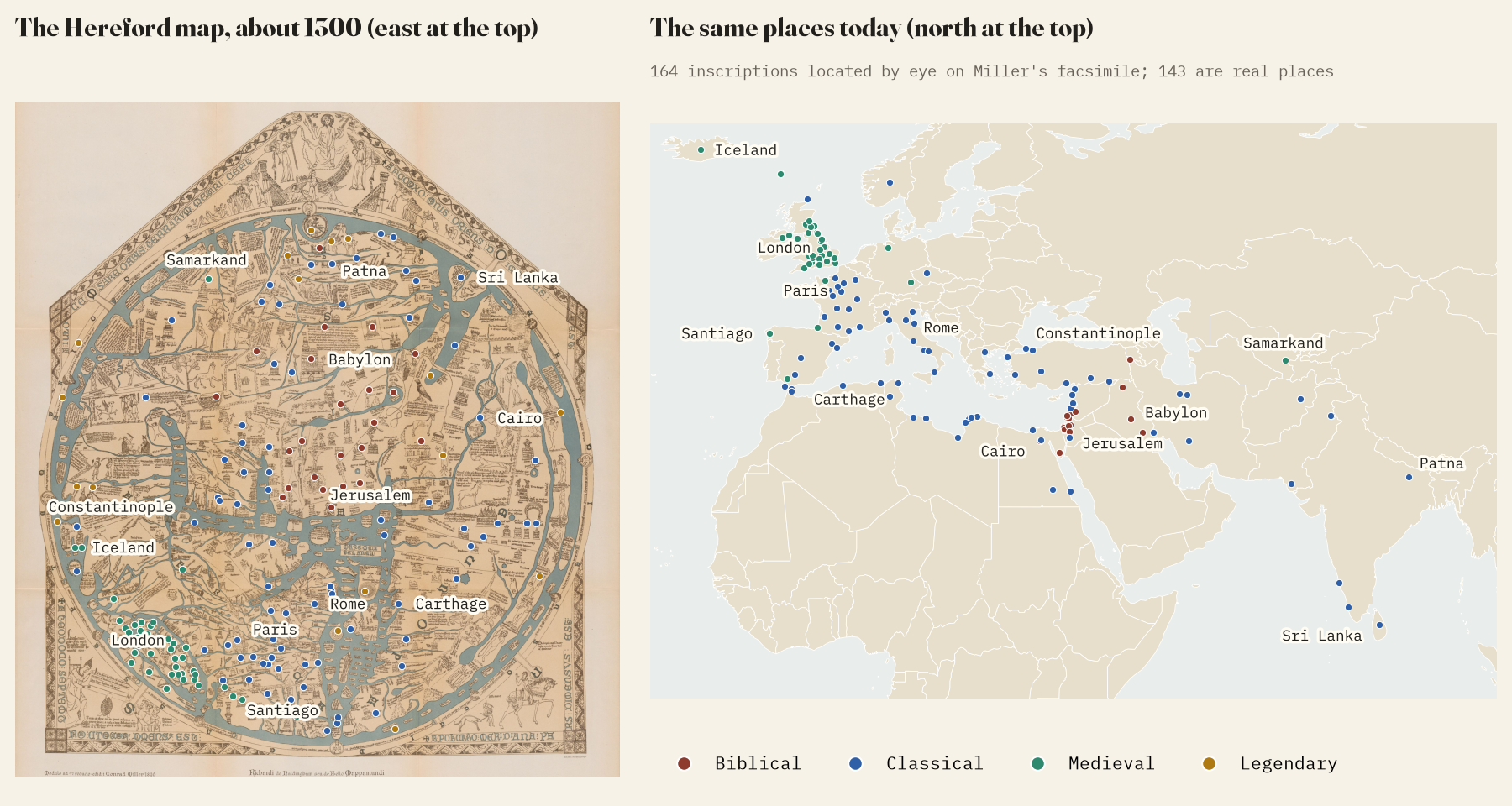
In 1873 two Herefordshire clergymen, W. L. Bevan and H. W. Phillott, published a book that went over the map name by name, region by region, and ended with an index of 1,025 names. I used that index as the map’s inventory. I located 164 of the clearest inscriptions by eye on Konrad Miller’s 1896 facsimile, which is far easier to read than the worn original, and placed the 143 the book identifies with a real place on a modern map.
Bible, classics, Middle Ages and marvels
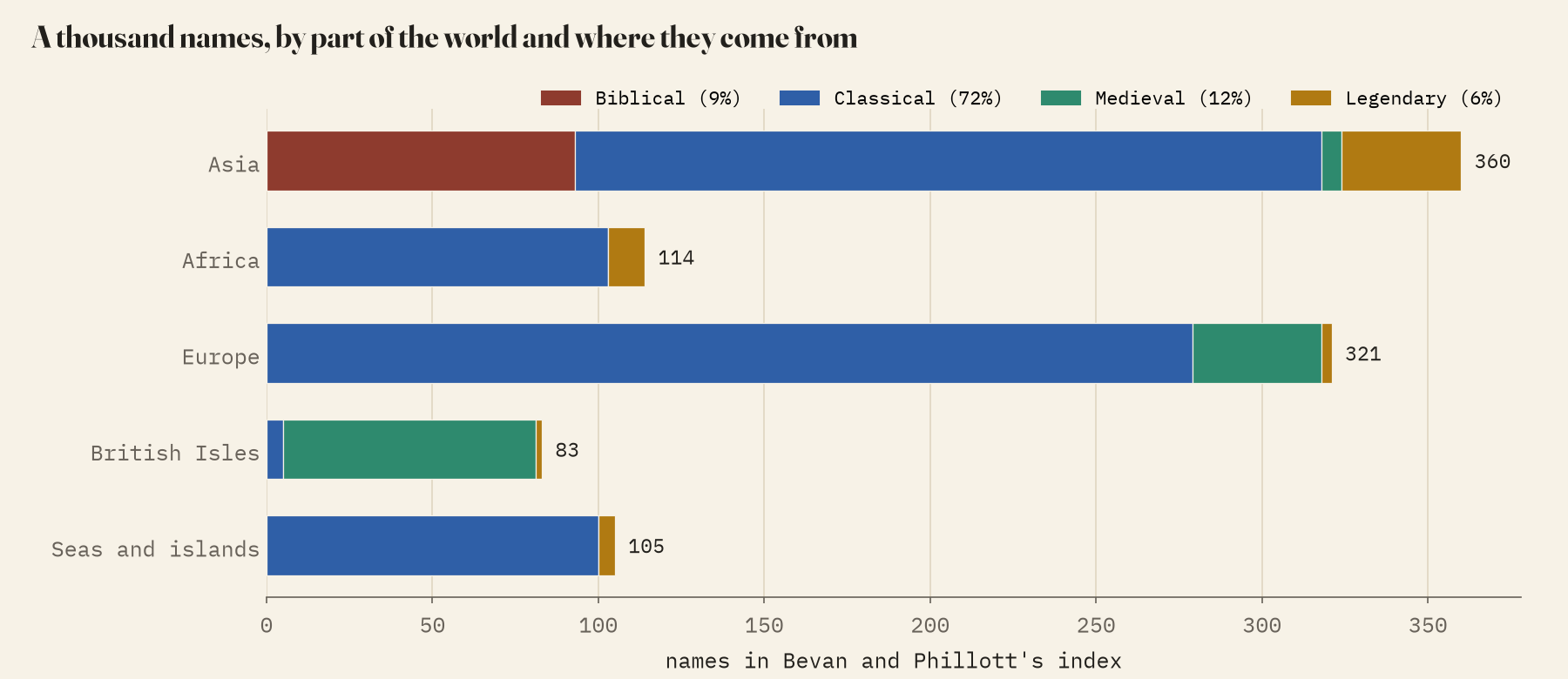
Bevan and Phillott sorted the map’s contents into four kinds of material: Biblical, classical, legendary and what they called contemporaneous, the knowledge of the mapmaker’s own day. Sorting every name the same way, 72% are classical, Greek and Roman places and peoples copied mostly from late Roman compilers and a Roman road book. 9% are Biblical, 12% medieval, and 6% pure legend: Paradise, Gog and Magog, the Golden Fleece, the Minotaur’s labyrinth and the monstrous races. Every Biblical name is in Asia. Only in Britain and Ireland is the map up to date: 92% of the names there are medieval.
Roughly the right way
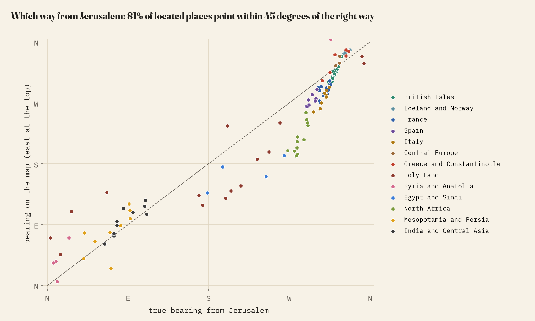
Turn the map so that east is at the top and directions from Jerusalem hold up surprisingly well. For the 140 real places I located, the median error is 19 degrees, and 81% point within 45 degrees of the right way. London is on a bearing of 318 degrees from Jerusalem; the map puts it at 306. The big exception is Africa. Because the Mediterranean is drawn as a straight channel from Gibraltar up to the Holy Land, North Africa swings round to the south, a median 69 degrees off.
Wildly out of scale
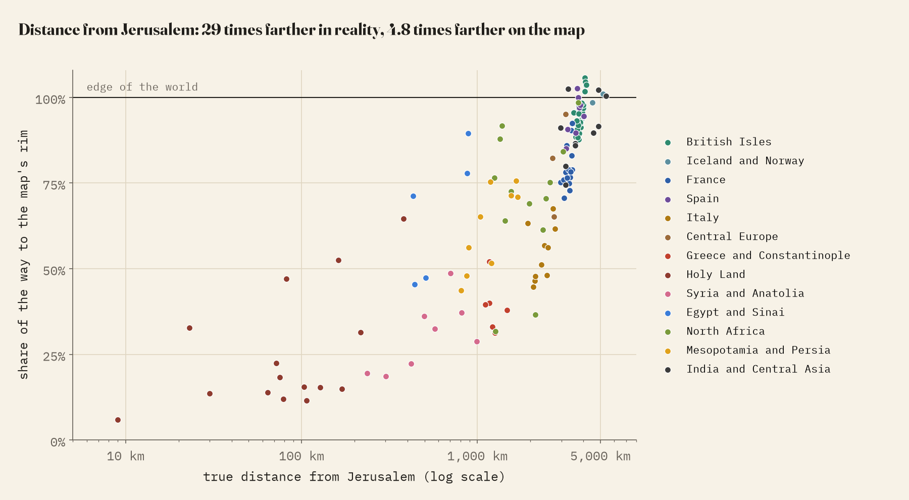
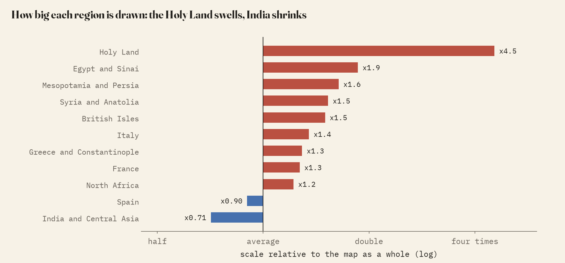
Distance is another matter. Places close to Jerusalem, a median 128 km away, sit 20% of the way out to the rim. Places 3,000 km or more away sit at 93%. They are 29.3 times as far in reality but only 4.8 times as far on the map. Everything distant is pressed against the encircling ocean, while the Holy Land swells: it is drawn 4.5 times bigger than the map’s average, Egypt 1.9 times, the British Isles 1.5. India and Central Asia shrink to 0.71.
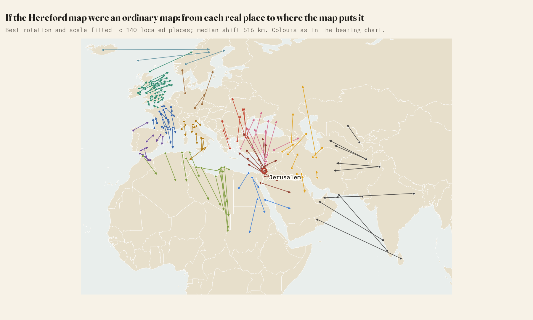
If you lay the whole map on the globe with the best possible rotation and scaling, the median place lands 516 km from where it really is. The arrows below show where each one would fall.
Home
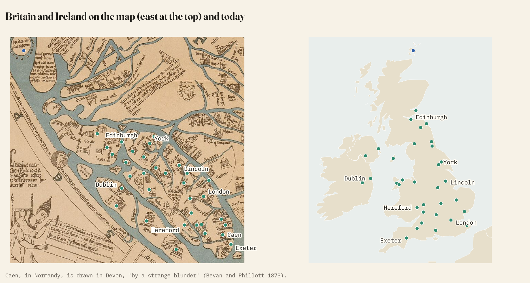
Britain and Ireland are 0.4% of the land of Africa, Asia and Europe, but they have 83 names, 8.1% of the index, about 21 times their share. Here the mapmaker knew the ground: cathedral cities and abbeys, Lincoln on its hill, Ely on its island in the fens, the rivers of the Humber drawn, Bevan and Phillott thought, with “a degree of accuracy which implies personal acquaintance”. He still made mistakes. Caen, in Normandy, ended up in Devon, “by a strange blunder”.
How I did this
The inventory is the index of Bevan and Phillott’s Mediaeval Geography (1873), read from the Internet Archive’s scan. I sorted every name into the book’s four kinds of material with a fixed rule, set out in the paper. The 164 positions on the map are my own, located by eye on Miller’s facsimile, so they favour the legible and well-known places. Identifications are the 1873 book’s for the located places, and name matches in the Pleiades gazetteer of ancient places for 194 more, each checked by hand. Directions and distances are measured from the centre of Jerusalem on the map and on the globe. For a complete modern edition of every inscription, see Scott Westrem’s The Hereford Map and the Virtual Mappa project.
Notes and sources
- W. L. Bevan and H. W. Phillott, Mediaeval Geography: an essay in illustration of the Hereford Mappa Mundi (1873), public domain.
- Konrad Miller’s 1896 facsimile and a photograph of the map, Wikimedia Commons, public domain.
- Pleiades gazetteer of past places, version 4.1, CC BY 3.0; Natural Earth (public domain); Wikipedia, Hereford Mappa Mundi, CC BY-SA 4.0.
- I wrote the text, with drafting and editing assistance from Claude (Anthropic), which also helped prepare the analysis code. I reviewed and checked all text and results.


