
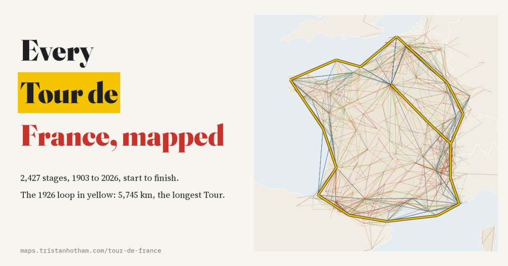
The first Tour de France had six stages. Since then the race has been held 113 times, over 2,427 stages. I put every one of them on a map, from start town to finish town, and watched a lap of France turn into something else entirely.
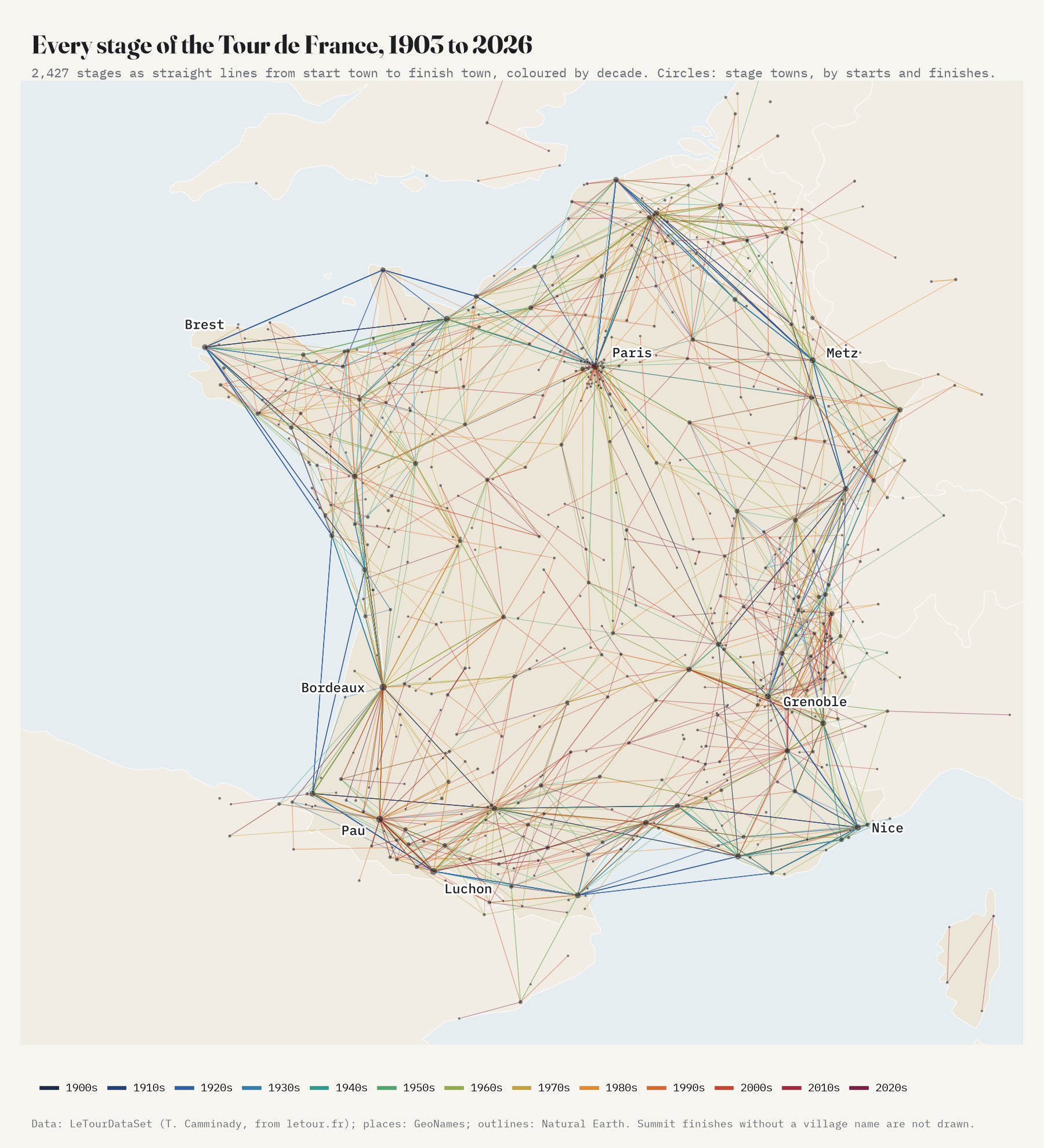
Every stage of every Tour is listed on the official race website, and Thomas Camminady has gathered those pages into LeTourDataSet, a free table of every stage and every rider since 1903. It names each stage’s start and finish town, but not where they are. So I matched all 863 town names against GeoNames, a free gazetteer, and located 95.8% of the 4,938 starts and finishes. Then I drew each stage as a straight line.
A lap of France
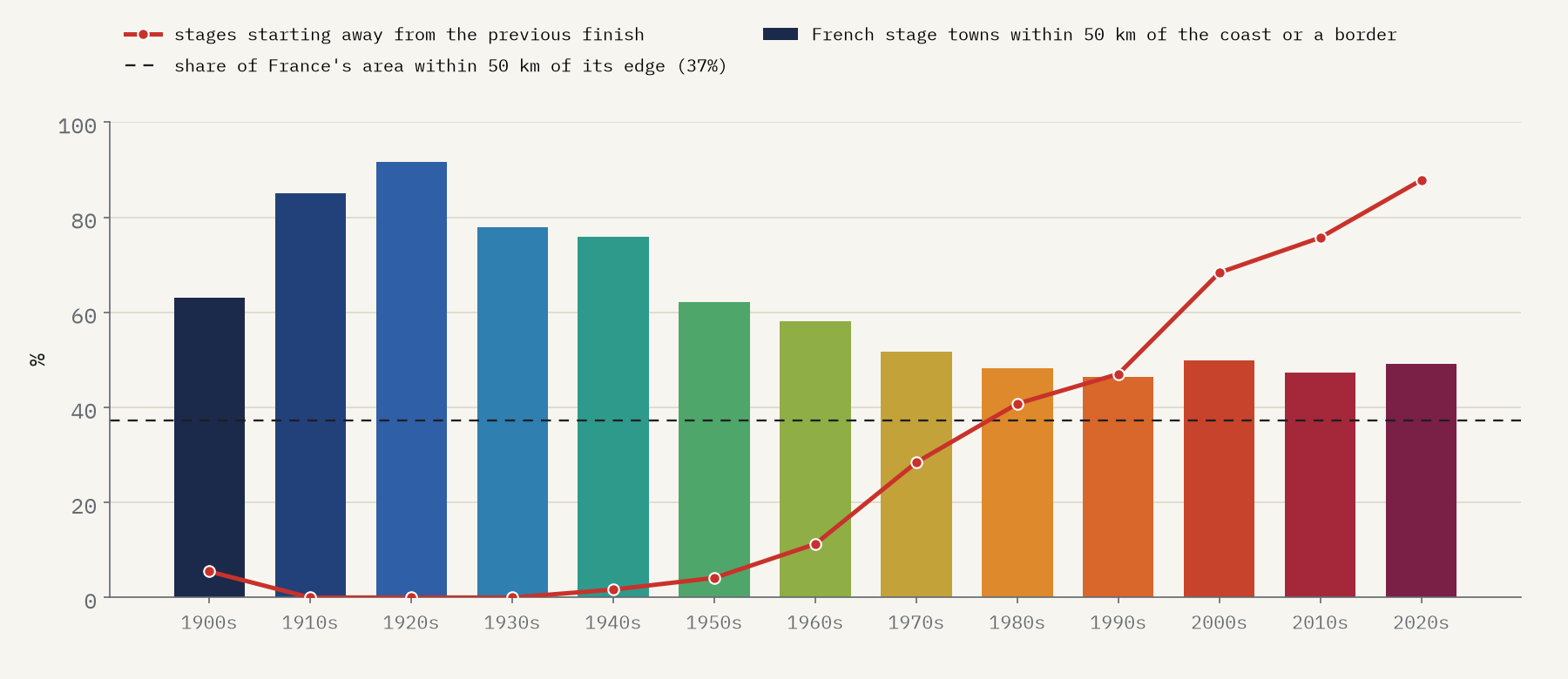
The dark blue lines round the edge are the early Tours, and they really were a tour: a lap of the coasts and frontiers. In the 1920s, 92% of the French towns the race stopped in lay within 50 km of the sea or a border, although only 37% of France is that close to its edge. And the loop never broke. Through the 1910s, 1920s and 1930s every single stage started in the town where the last one finished.
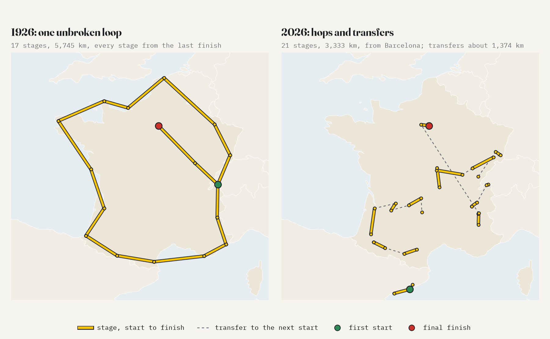
Today’s Tour is a set of hops. In the 2020s, 88% of stages start somewhere other than the previous finish, and the gaps add up to about 1,152 km a race as the crow flies. The biggest single leap in the data is 681 km, from Espelette in the Basque Country to Houilles near Paris in 2018.
Shorter and faster
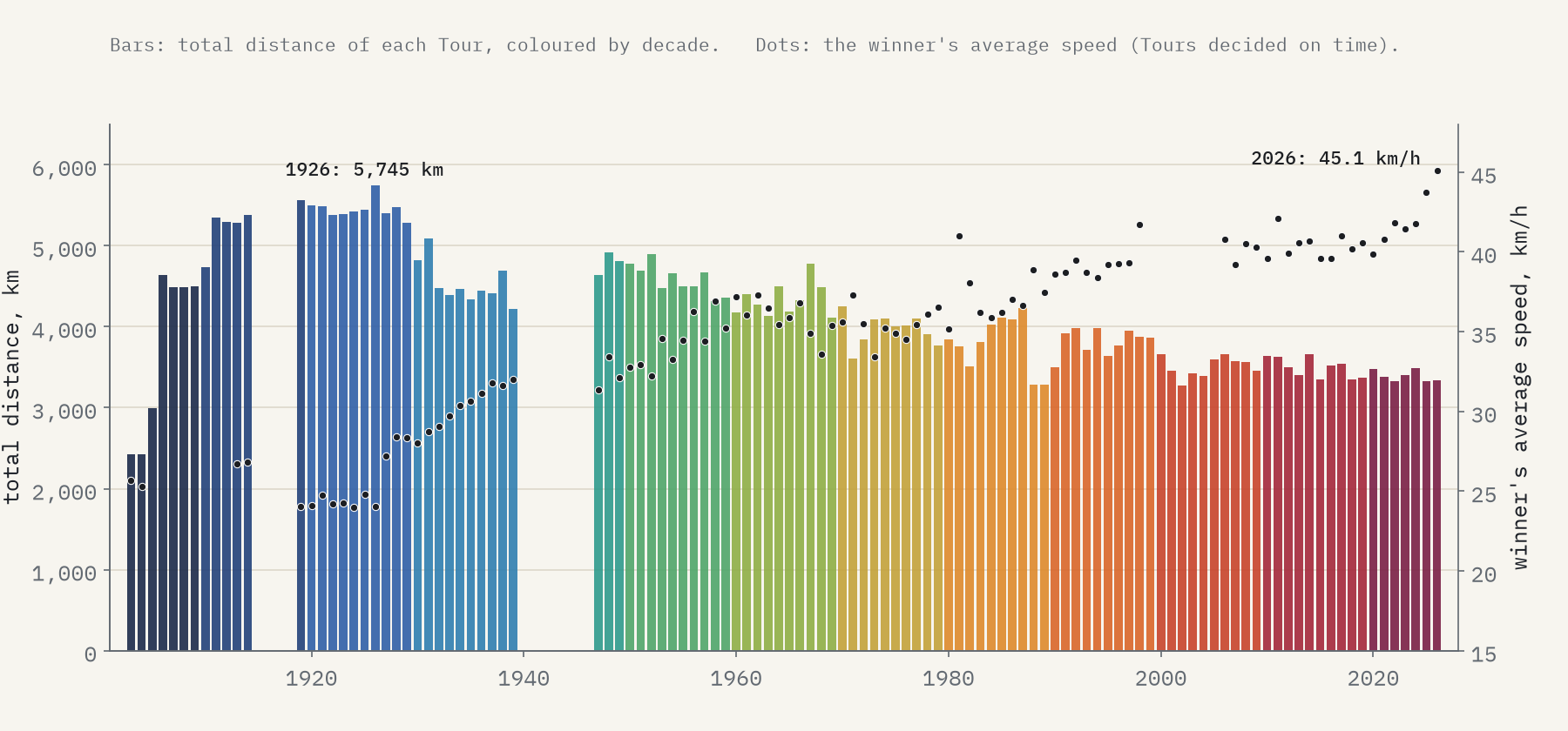
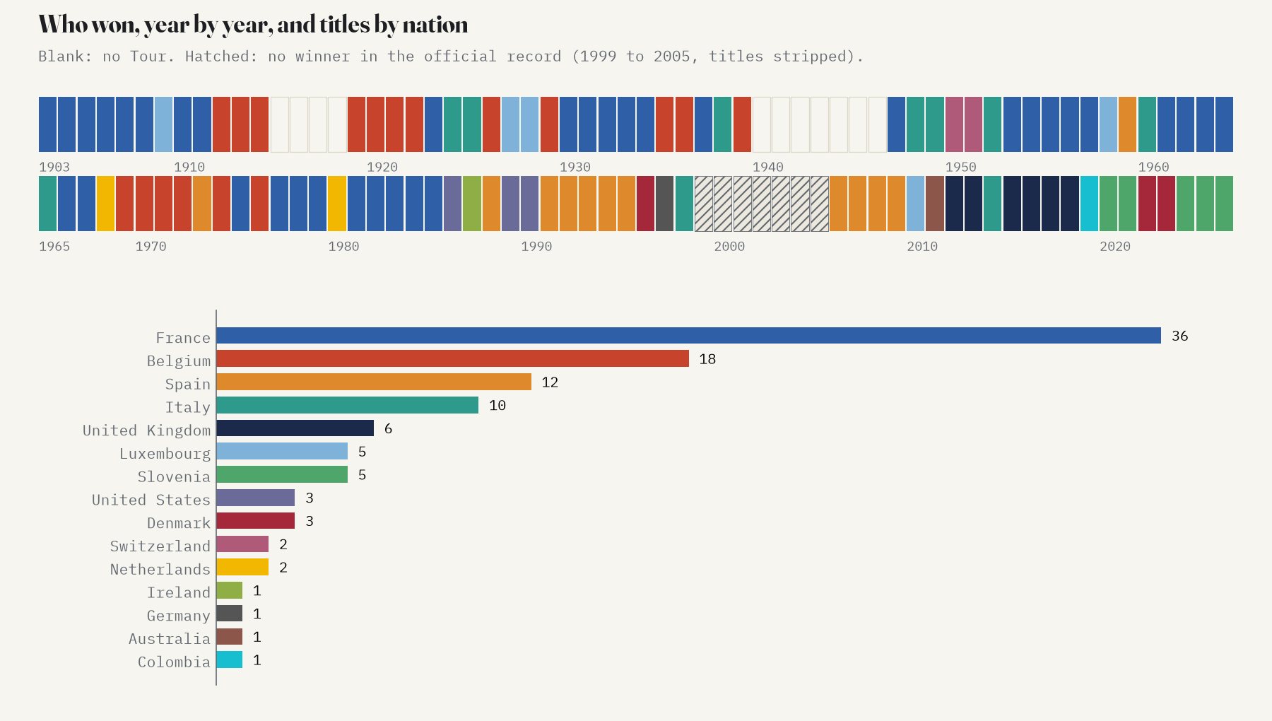
The longest Tour was in 1926: 5,745 km, won by Lucien Buysse after 239 hours in the saddle at 24.1 km/h. The 2026 race was 3,333 km, 42% shorter, and Tadej Pogačar won it at 45.1 km/h, the fastest winning average ever. The official record has no winner at all for 1999 to 2005: Lance Armstrong’s seven titles were stripped and never reawarded.
Paris, Bordeaux, Pau
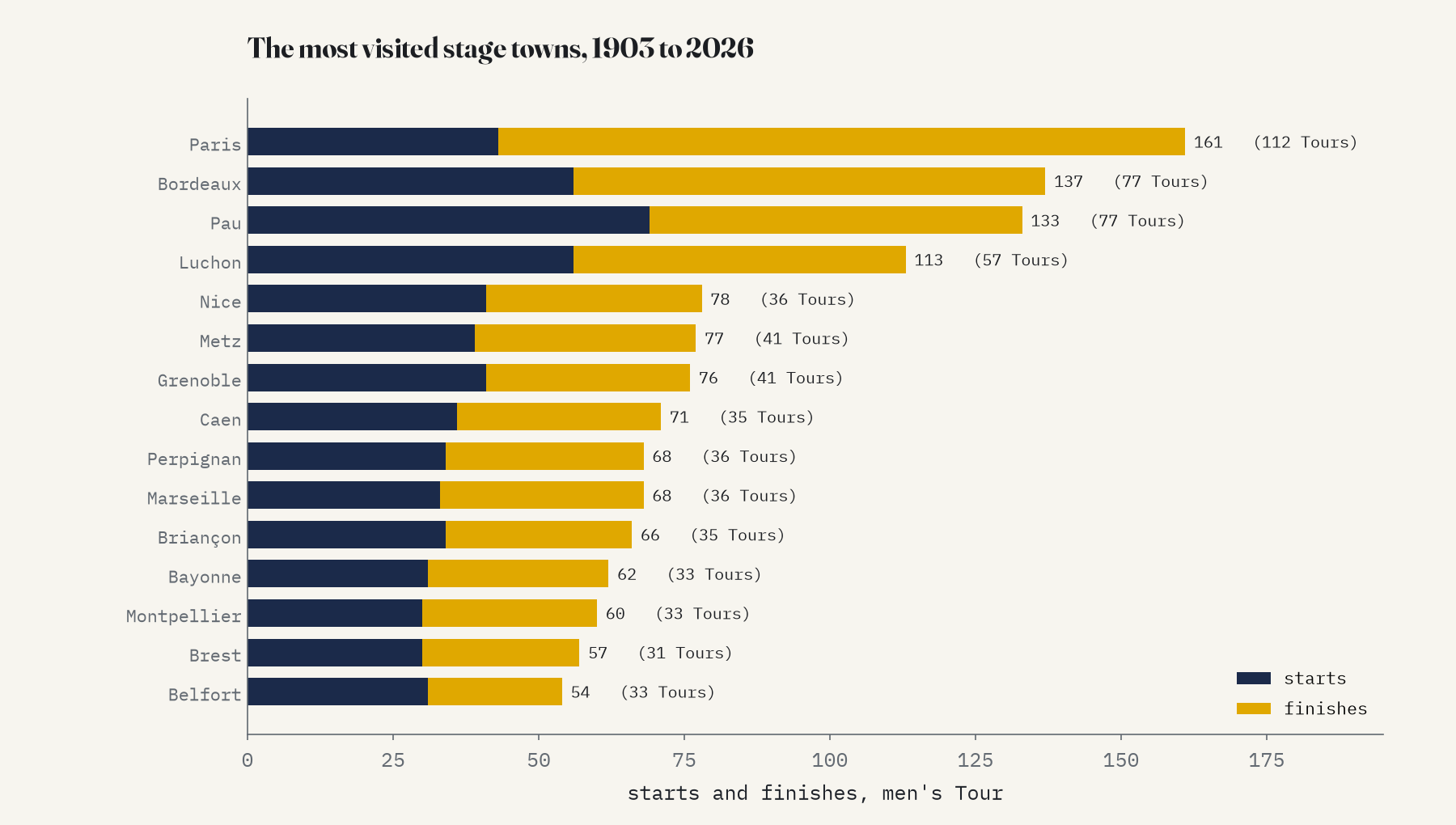
The race has stopped in 701 places, but it keeps going back to the same few. Paris has 161 starts and finishes, and every Tour has ended there except 2024, which finished in Nice. Then come the gateways to the Pyrenees: Bordeaux (137), Pau (133) and Luchon (113). And it has been everywhere at least once: every one of the 96 départements of mainland France has hosted a start or a finish, though Corsica had to wait until 2013.
Going abroad
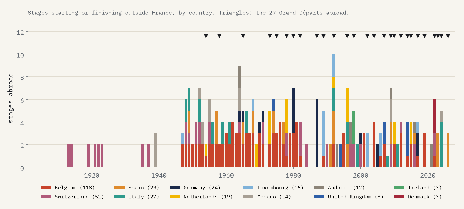
The Tour first left France in 1913, with a stage from Grenoble to Geneva. It first started abroad in 1954, in Amsterdam, and has done so 27 times in all, from Dublin to Florence and Copenhagen. Since 2000 it has become normal: 14 of the last 27 Tours began outside France. Belgium is the race’s second home, with 118 stages.
Who won
French riders have won 36 Tours, but none since Bernard Hinault in 1985. Belgium has 18, Spain 12 and Italy 10. Five men have won five times: Anquetil, Merckx, Hinault, Indurain and, most recently, Pogačar.
How I did this
Stages come from LeTourDataSet; places from GeoNames cities1000. I matched names without accents or hyphens, and wrote a table of 150 special cases: French names for foreign towns (Londres, Gand), short names (Luchon), venues inside a town (Futuroscope) and ski stations named after their village (Alpe d’Huez). Summit finishes with no village in their name, such as the Puy de Dôme and Mont Ventoux, are left off rather than guessed, so the high mountains are under-drawn. The lines are straight, not roads. The data has no nationality for riders, so I added the winners’ nationalities by hand. The Tour de France Femmes, 42 stages since 2022, is a separate layer on the interactive map. The paper sets out every step and caveat.
Notes and sources
- Thomas Camminady, LeTourDataSet, MIT licence, compiled from the official letour.fr and letourfemmes.fr historical pages.
- GeoNames cities1000, CC BY 4.0, as packaged by lutangar/cities.json.
- Natural Earth outlines (public domain).
- I wrote the text, with drafting and editing assistance from Claude (Anthropic), which also helped prepare the analysis code. I reviewed and checked all text and results.

