
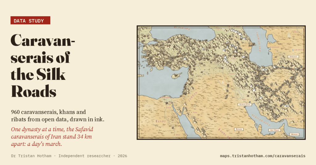
For a thousand years, merchants on the Silk Roads slept behind the walls of caravanserais, built, we are told, a day’s march apart. I put 960 of them on a hand-inked map from open data and measured the gaps. The day’s march is there, but only if you look at one dynasty at a time.
A caravanserai is a fortified inn. Picture a square of high blank walls with round towers at the corners and one tall, decorated gateway. Inside is a courtyard with a well, rooms for the merchants round it, and stables and storerooms behind. At dusk the gate was shut. From Anatolia to Iran and Central Asia, from the Seljuk sultans of the thirteenth century to the Safavid shahs of the seventeenth, rulers and rich patrons built them along the trade roads so that a caravan could leave one at dawn and reach the next by nightfall.
That last claim, a day’s march apart, is repeated everywhere and usually put at 30 to 40 km for laden camels or mules. I wanted to test it, and to see how much of this world open data still remembers.
Two countries, two great chains
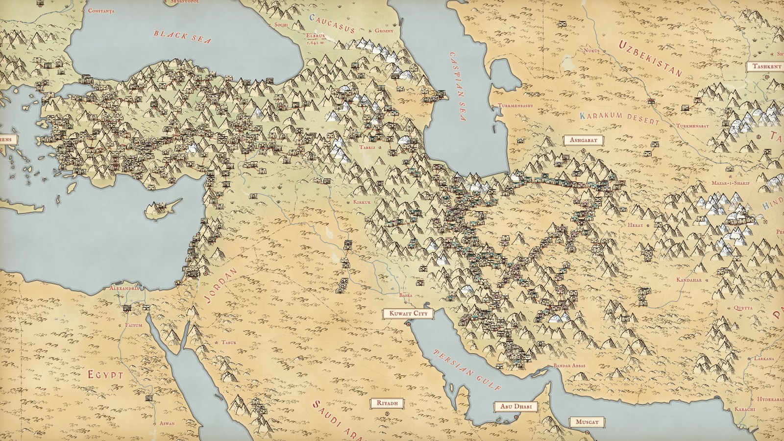
I merged two open sources. Wikidata, the database behind Wikipedia, has 864 caravanserais, khans and ribats with coordinates. OpenStreetMap’s volunteer mappers have tagged 281 buildings as caravanserais, and 185 of them turned out to be the same buildings as in Wikidata. That leaves 960 records in 33 countries and territories.
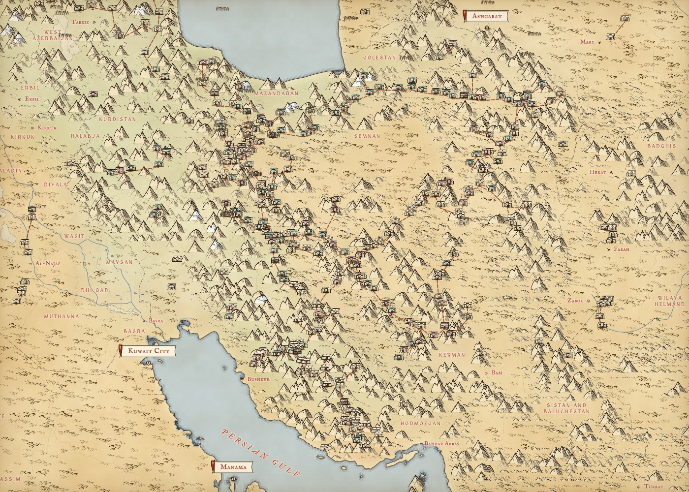
The map is lopsided. Turkey has 401 and Iran 352, 78% of the whole. Some of that is history: the Seljuks and the Safavids built on a grand scale. Much of it is bookkeeping. Turkish editors have put hundreds of hans into Wikidata, and 213 of Iran’s caravanserais are on its national heritage list. Central Asia, home of Samarkand and Bukhara, has only 52, the Grand Trunk Road of India and Pakistan 17, and China none.
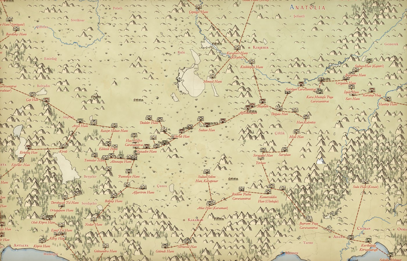
Join each stop to its nearest neighbours and long chains appear. The longest runs for 273 stops across Anatolia, from Çeşme on the Aegean to the Tigris near Cizre, 1,398 km as the crow flies. The next crosses Iran from the Caspian to the Gulf. On the interactive map little camel trains walk along these links. They are my inference from where the inns stand, not mapped roads, but many of them follow roads you can still drive.
A day’s march, but only one dynasty at a time
Here is the surprise. Measure the distance from every stop to its nearest neighbour and the typical gap is only 21 km. Just 12% of gaps fall in the 30 to 40 km of a day’s march, and 48% are under 20 km. On the map, the caravanserais crowd far closer than the textbook says.
The reason is time. A road used for eight centuries collects inns from many builders. A Seljuk han, an Ottoman one a few kilometres on; a Safavid caravanserai, and a Qajar one beside it; a small stop squeezed between two big ones. Put them all on one map and the gaps shrink. So I took one dynasty at a time. The 90 Safavid caravanserais of Iran stand a median 34 km from the nearest other Safavid one, and half the gaps lie between 26 and 50 km. That is a day’s march.
All together, the caravanserais crowd closer than a day’s march. One dynasty at a time, the old rhythm comes back.
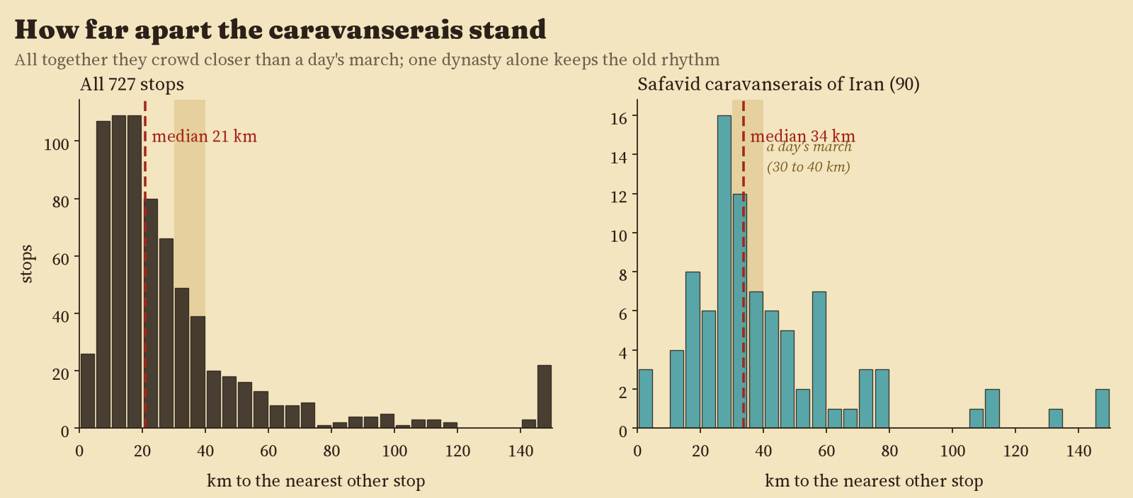
The later Qajar caravanserais are further apart from each other (median 46 km), which is what you would expect if they filled gaps in a network that already existed rather than building a new one.
Who built them
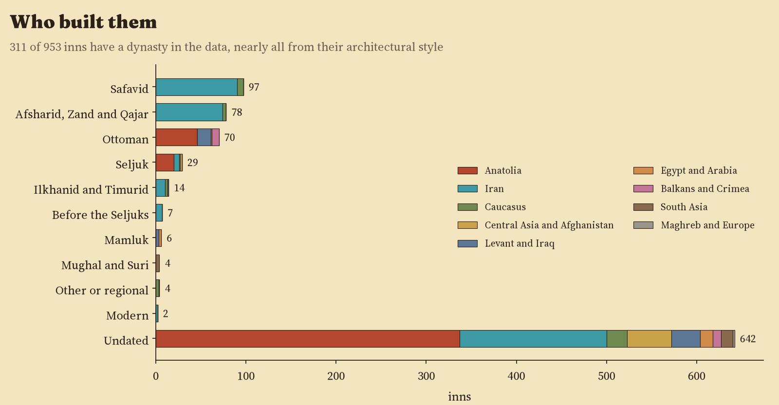
Dates are the scarce thing. Only 311 of the 953 inns (33%) can be given a dynasty, nearly all from their architectural style rather than a date; just 61 have a year of building. Safavid is the commonest (97), then Qajar and its predecessors (78), Ottoman (70) and Seljuk (29). That Seljuk number is far too low: the famous thirteenth century hans of Anatolia, like Sultan Han on the road from Konya to Aksaray, are on the map, but most have no style or date in Wikidata.
What survives
311 inns carry a heritage listing in Wikidata, almost all in Iran, where 66% of mapped caravanserais are listed and 47 are part of UNESCO’s World Heritage Site of the Persian Caravanserai. In Turkey only 1 is listed, which says more about Wikidata than about Turkey. OpenStreetMap marks 36 as ruins and 17 as hotels, guest houses, museums or restaurants. Travellers still sleep in some of them.
How I did this
I matched OpenStreetMap buildings to Wikidata items through their Wikidata tags or, failing that, by distance (within 150 m). Seven ribats in Tunisia, Portugal and Spain are forts or Sufi lodges rather than inns, so they are drawn as forts and left out of the counts. Inns within 3 km of each other count as one stop, so a city with five khans is one place on the road. Dynasties come from the architectural style in Wikidata, or from the year of building and the region. The links between stops are the shortest network joining them all, cut at 80 km. The base map is The Inked World, and every caravanserai is a little pen drawing washed in its dynasty’s colour.
The caveats matter. This is a map of records, not of history: what is missing (most of Central Asia, Arabia, India and China) is missing from the data, not from the past. Most inns are undated, a style is not a date, and straight-line gaps are shorter than the road.
Notes and sources
- Wikidata: caravanserais (Q186347), khans (Q115921107) and ribats (Q1333989) and their subclasses. CC0.
- OpenStreetMap contributors, features tagged as caravanserais, via the Overpass API. ODbL 1.0.
- Natural Earth countries and populated places (public domain). Base map: The Inked World (OpenStreetMap via OpenFreeMap, AWS Terrain Tiles, RESOLVE Ecoregions).
- Reading: K. Erdmann (1961) Das anatolische Karavansaray des 13. Jahrhunderts; M. Siroux (1949) Caravansérails d’Iran et petites constructions routières; M. Y. Kiani and W. Kleiss (1990) “Caravansary”, Encyclopaedia Iranica; R. Hillenbrand (1994) Islamic Architecture; UNESCO (2023) The Persian Caravanserai.
- I wrote the text, with drafting and editing assistance from Claude (Anthropic), which also helped prepare the analysis code. I reviewed and checked all text and results.

