
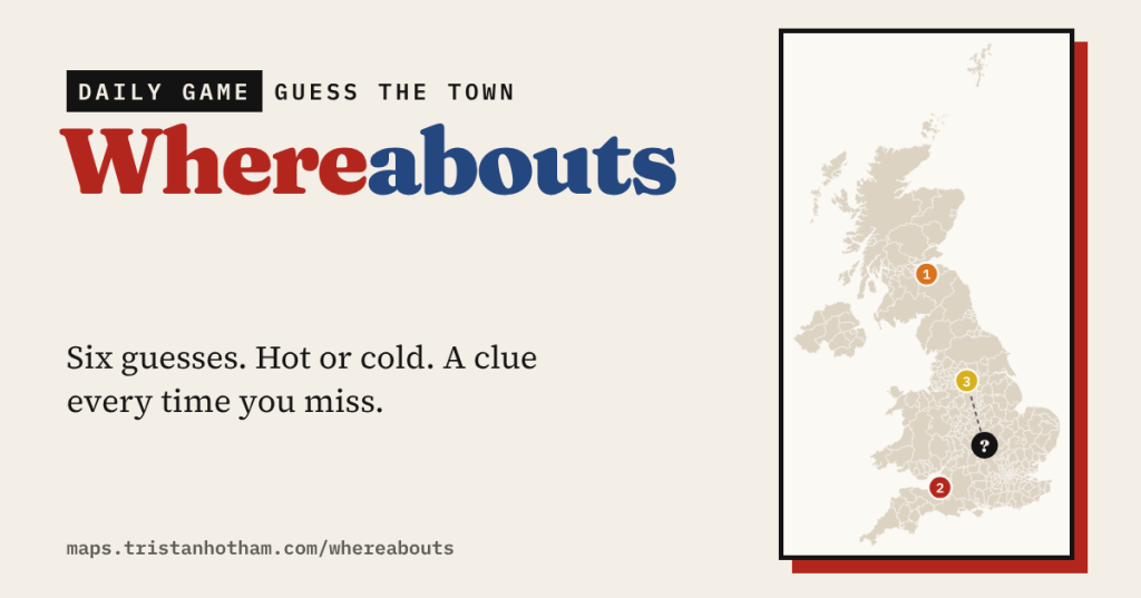
Somewhere in the UK is today’s mystery town. You have six guesses. Each one tells you how far off you are and which way to go, and every miss unlocks a clue, from sunshine and house prices to the oddest thing about the town’s council area. At the end you find out what its name means.
Whereabouts is a map game in the spirit of Wordle and Worldle, built from the data behind my other maps. Most map-guessing games show you a shape or a photo and leave you to it. I wanted one where the hints are the interesting part: every wrong guess should teach you something about the place you’re looking for.
How it works
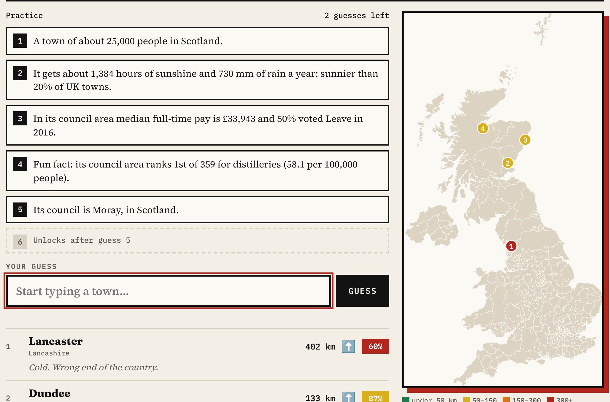
Type a town and pick it from the list. You’ll see the straight-line distance to the mystery town, an arrow pointing the right way, and how close you are as a percentage. Each guess goes on the map as a numbered dot coloured hot or cold, with a comment to match, from “Very warm. You can almost smell the chippy” to “Arctic. Are you sure you’re in the UK?”
Every miss unlocks the next clue, and they get sharper as you go:
- Its size and country: “A town of about 25,000 people in Scotland.”
- Its weather: hours of sunshine, rainfall, and how sunny it is compared with other UK towns.
- Money and politics in its council area: the median house price (or pay) and the Leave vote in 2016.
- The oddest thing about its council area. For Elgin it’s “ranks 1st of 359 for distilleries”; for Burnley, “the lowest median house price of 314 councils”.
- Its county or council.
- Its first letter and how many letters it has.
What’s in a name
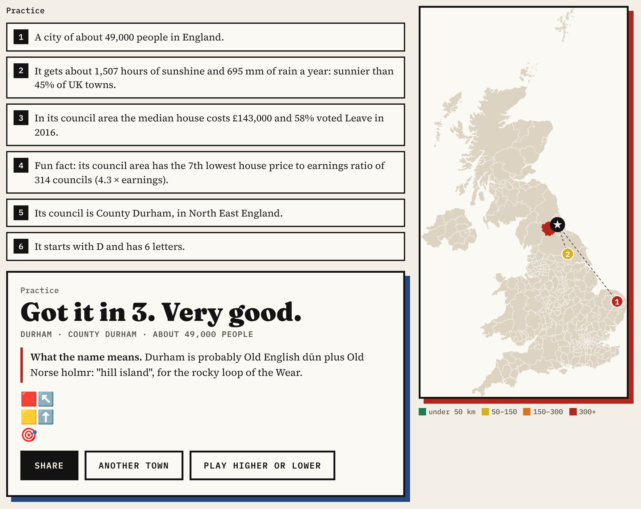
When the game ends, the town appears on the map with dotted lines from each of your guesses. For many towns you also learn what the name means. Place names are some of the oldest things we have, and their endings tell you who named a place and what they saw there. A -by or -thorpe is usually Old Norse, a farm or settlement left by Viking-age settlers. A -chester, -caster or -cester marks a Roman fort. A -ley is a clearing in a wood, a -ford a river crossing, and aber- and inver- are the Brittonic and Gaelic words for a river mouth.
Rules like these go wrong, so I checked the answers and wrote some by hand. Durham isn’t a -ham at all but probably “hill island”, for the rocky loop of the Wear. Boston is “Botolph’s stone”. Pontefract is Latin for “broken bridge”. High Wycombe is probably “at the dwellings” rather than a valley. Where I couldn’t find a reliable explanation, the game simply doesn’t give one.
Daily or practice
Today’s town is the same for everyone, drawn from about 240 UK cities and larger towns, so you can compare scores and keep a streak. Your result is a grid of coloured squares and arrows to share, without spoiling the answer for anyone else. Practice gives you a random town from about 560, whenever you like. You can guess any of about 3,000 towns.
How I built it
The towns come from OS Open Names and GeoNames, via my Sun and Rain map, with populations from the ONS 2022 built-up areas. The weather clues are Met Office averages for 1991 to 2020 at each town. The council clues use the 66 measures in Higher or Lower, my other daily game, from the ONS, the Electoral Commission and my own studies. For the fourth clue the game looks for the most unusual thing about each council area, starting with the Just for fun measures.
A few things to bear in mind. Distances are as the crow flies, from town centres. The council clues describe the whole council area, which can be much bigger than the town. And place-name meanings are the usual explanations of common elements: many names have more than one theory.
Notes and sources
- Towns: OS Open Names (contains OS data © Crown copyright and database right 2026) and GeoNames (CC BY 4.0). Populations: ONS built-up areas, Census 2021.
- Weather: Met Office HadUK-Grid climate averages, 1991 to 2020.
- Council clues: the measures in Higher or Lower, from the Office for National Statistics and Nomis, the Electoral Commission and my own studies. Council boundaries: ONS. Open Government Licence v3.
- The game, the town data and the code are on GitHub. Code MIT; derived data CC BY 4.0.
- I made this with coding and drafting help from Claude (Anthropic). I reviewed and checked the data and text.

